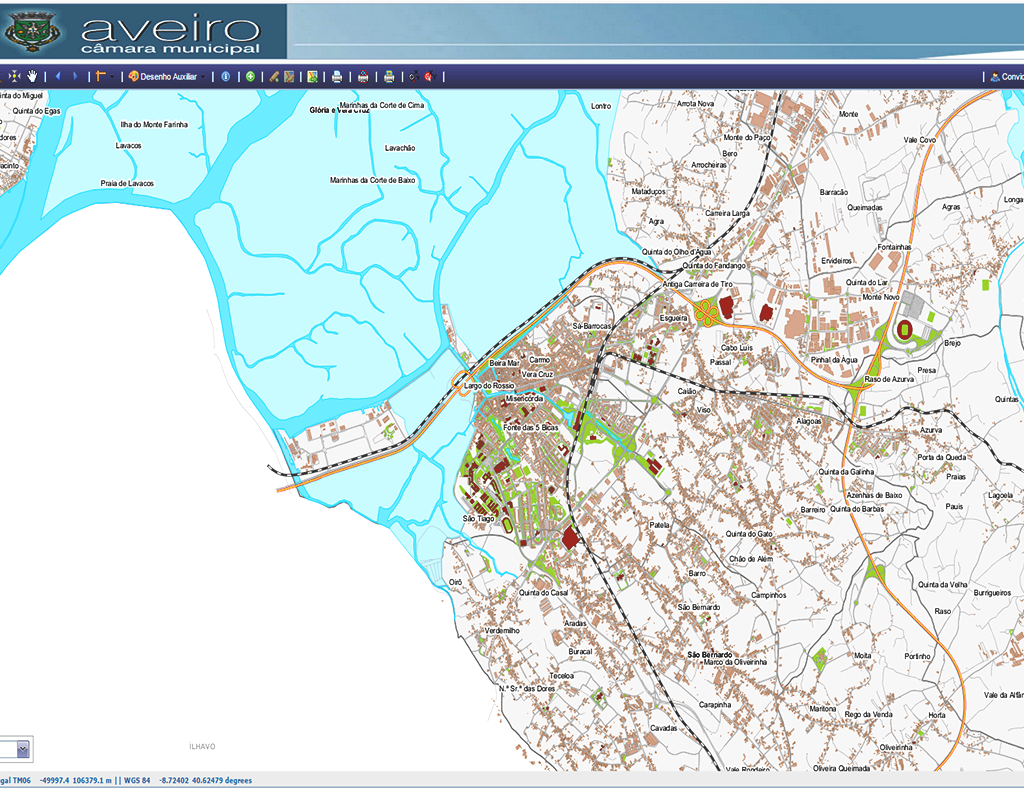
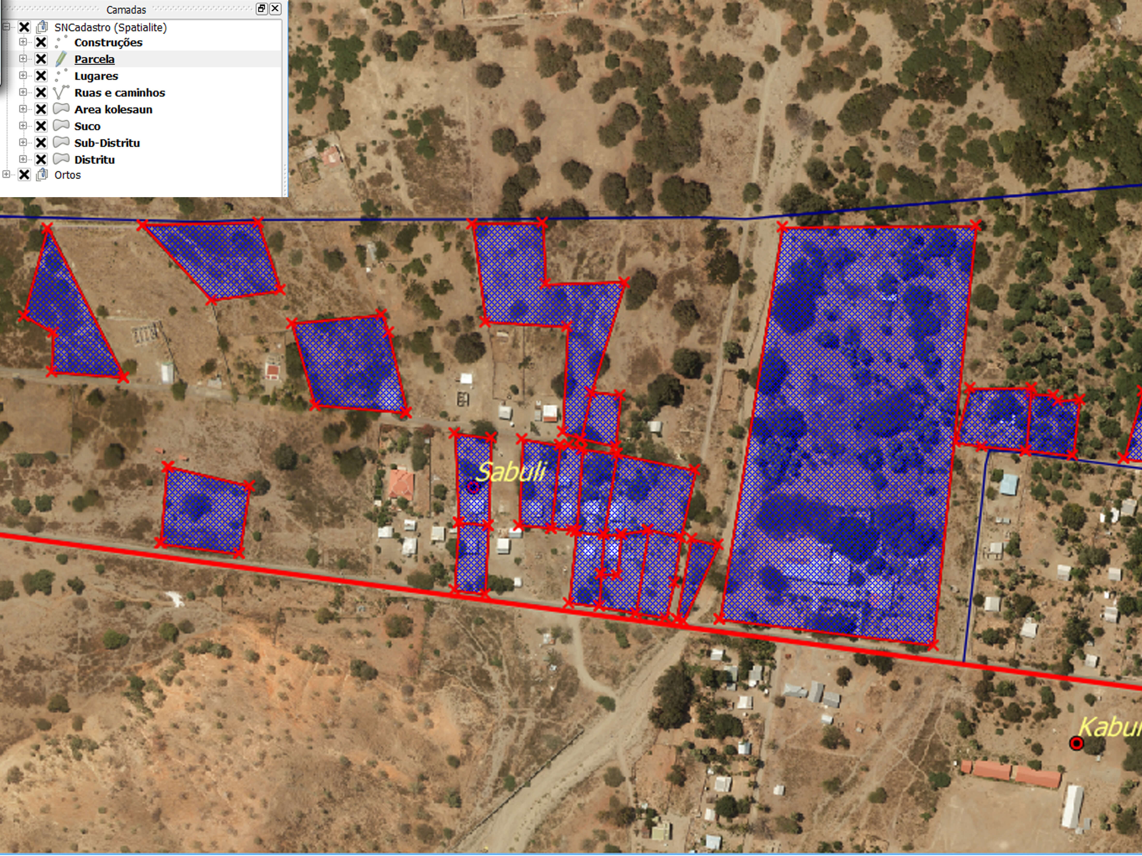
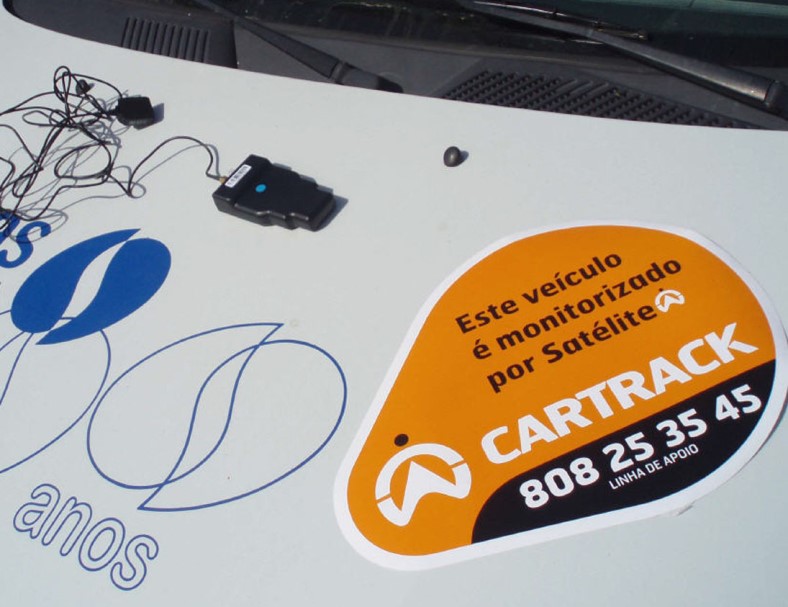
Archive

About the Project: Scope: Fleet Management Location: Lisbon Characteristics: Fleet Management Solution for 400 municipal vehicles, with installation of devices and implementation of Platform for monitoring, management, visualization and location of units in real time and access to reports and alerts for business support.  ...

About the Project: Scope: Aerophotogrammetric survey of Lisbon Airport esc 1/1000 and determination of aeronautical data Location: Lisbon Airport Characteristics: Digital Terrain Models (DTM) and High Resolution Surface (DSM).    ...

About the Project: Scope: Land Registry Location: Oliveira do Hospital and Seia Characteristics: 37 Parishes (16 + 21) / 67,021 hectares (23,452ha + 43,569ha) - Development of a management platform, collection and integration of all cadastral information; installation of service offices; production of support cartography; publicizing the operation;...

About the Project: Scope: Renewable energies and underground infrastructure Location: Oeiras Characteristics: Municipia has implemented the “Green Energy” platform, which municipalities are expected to be able to assess their solar potential and compare with their energy consumption, in order to establish more realistic and optimized goals and policies...

About the Project: Scope: Cartography of Flood Zones in the river beds Location: Oeiras Characteristics: Digital Terrain Models (DTM) and High Resolution Surface (DSM).          ...

About the Project: Scope: Management in the Central Government Location: Angola Characteristics: Recruitment and selection of technicians; formation; programming the data collection form using GPS + Netbooks; planning of data collection routes; coordination of fieldwork; data validation; development of the webGIS application for the exploration of census data.        ...

About the Project: Scope: Municipal Management Location: Aveiro Characteristics: Installation of open source software architecture; data transformation between different reference systems (HGD73 for ETRS89 PT TM-06); definition of the system architecture; import of Geographic Information into PostgreSQL / PostGIS according to the INSPIRE directive; implementation of the data...

About the Project: Scope: Natural, technological and mixed risks for Ribeira Brava, Porto Moniz, S. Vicente, Santana Local: Ribeira Brava, Porto Moniz, S. Vicente, Santana Characteristics: Review of the Municipal Emergency Plans and elaboration of the hazard / susceptibility, vulnerability and risk mapping      ...

About the Project: Scope: Property Registration Location: Timor-Leste Characteristics: Development of a dedicated GIS platform for Cadastral Management (field and office), design of the Data Model, implementation and quality control of the data and training that allows the following tasks: verification of the quality of the property declarations...