


Geographic Data
01.
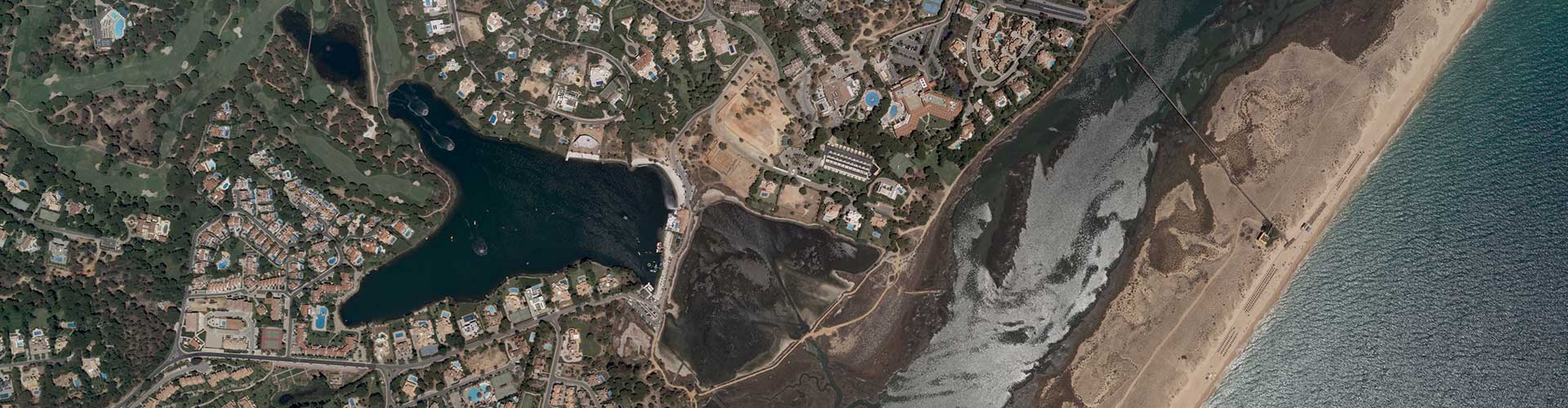
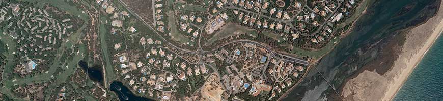
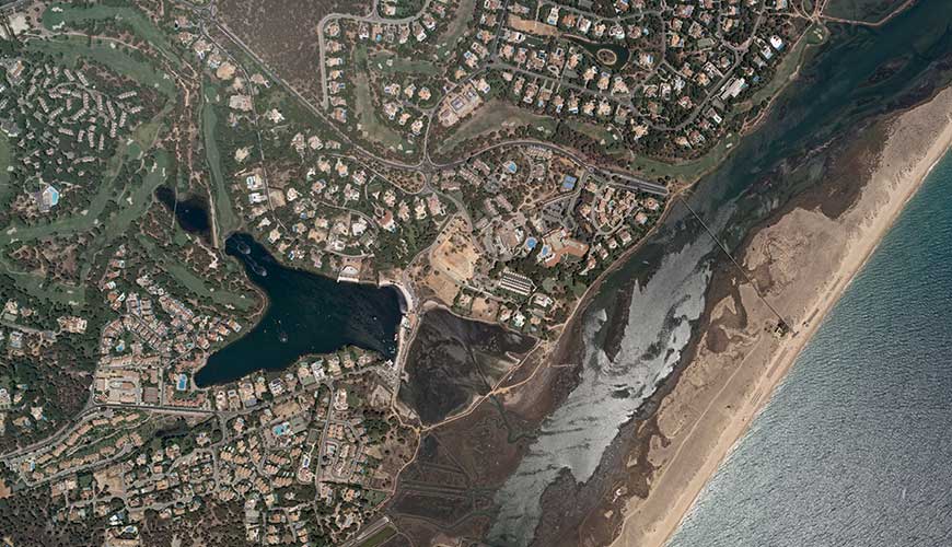
Aerial Surveys – Imagery, LIDAR, Multi and Hyperspectral and Thermal
We provide a vast collection of technologies for accurate and immediate results.
Characteristics
- Large format vertical aerial images with resolutions starting at 4 cm.
- RGB + NIR and Coordinates of Centres + Omega, Phi and Kappa.
- Digital Terrain and Surface Models produced from LIDAR scans.
- Terrain modelling applied to specific studies.
Fast and accurate modelling of large areas of territory, through:
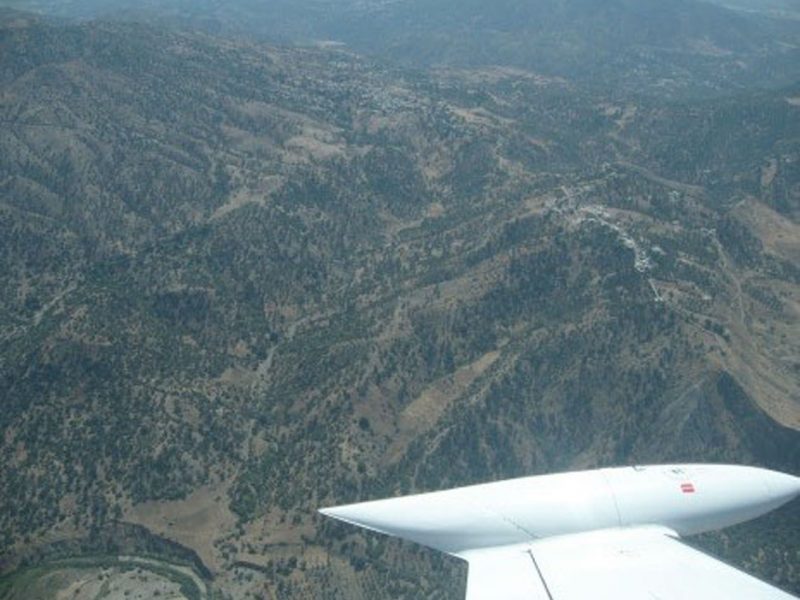
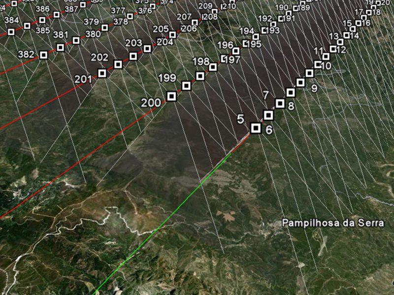
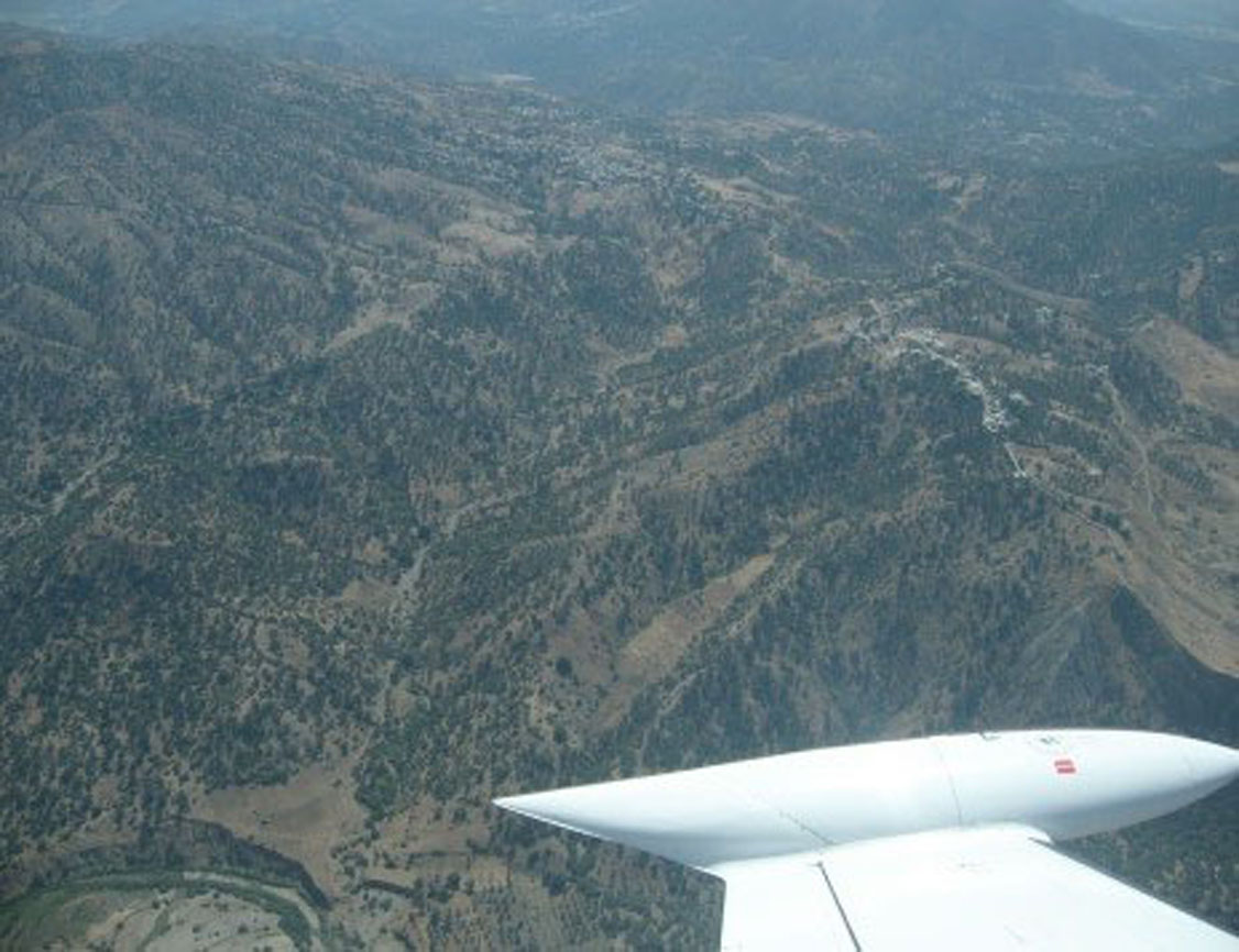
1.1 Aerial Photography
Is the basic raw material that we use in the execution of cartography and orthophotomaps, studies for agricultural and forest management, calculation of volumes, planning of communication routes, monitoring of electrical networks and supporting engineering projects.
Our Advantages
- High resolution survey, compared to satellite technologies;
- Coverage of large areas of territory, compared to UAV;
- Rapid surveys compared to classic survey methods;
- Immediate delivery right after processing;
- Direct integration in the cartography, orthophotomaps and GIS production process.
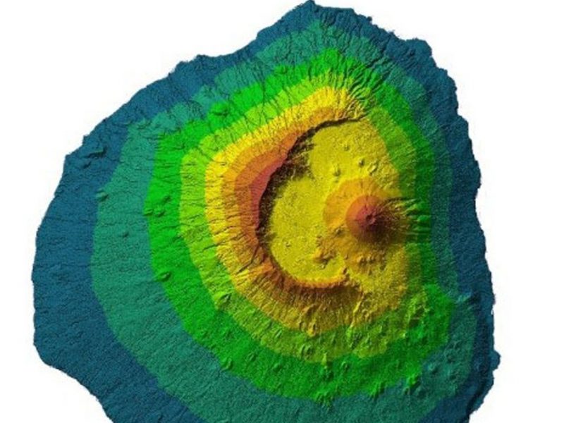
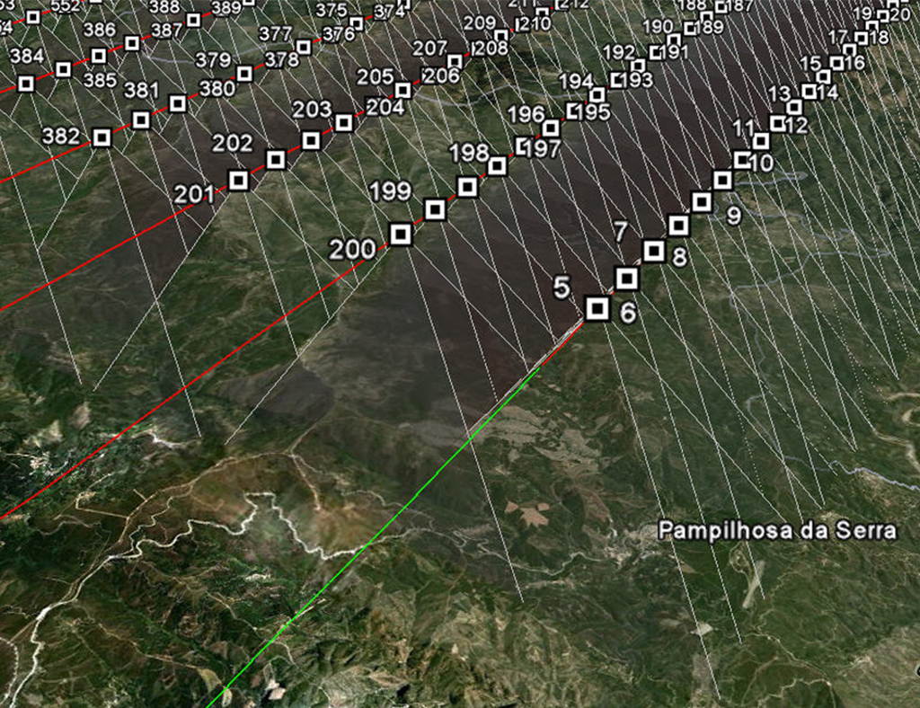
1.2 LIDAR Aerial Surveys
It is through Digital Terrain and Surface Models that we support our hydrological analysis, flood modelling, power line planning, network monitoring, environmental resource management, quantification of forest volumes and biomass and urban planning.
Our Advantages
- Acquisition of geographical bases in adverse physical and meteorological conditions;
- Terrain modelling immediately after the flight;
- Possibility of classifying objects by the intensity and interpretation of the 4 returns received;
- High vertical precision, robustness and homogeneity in the data set produced.
Success cases
02.
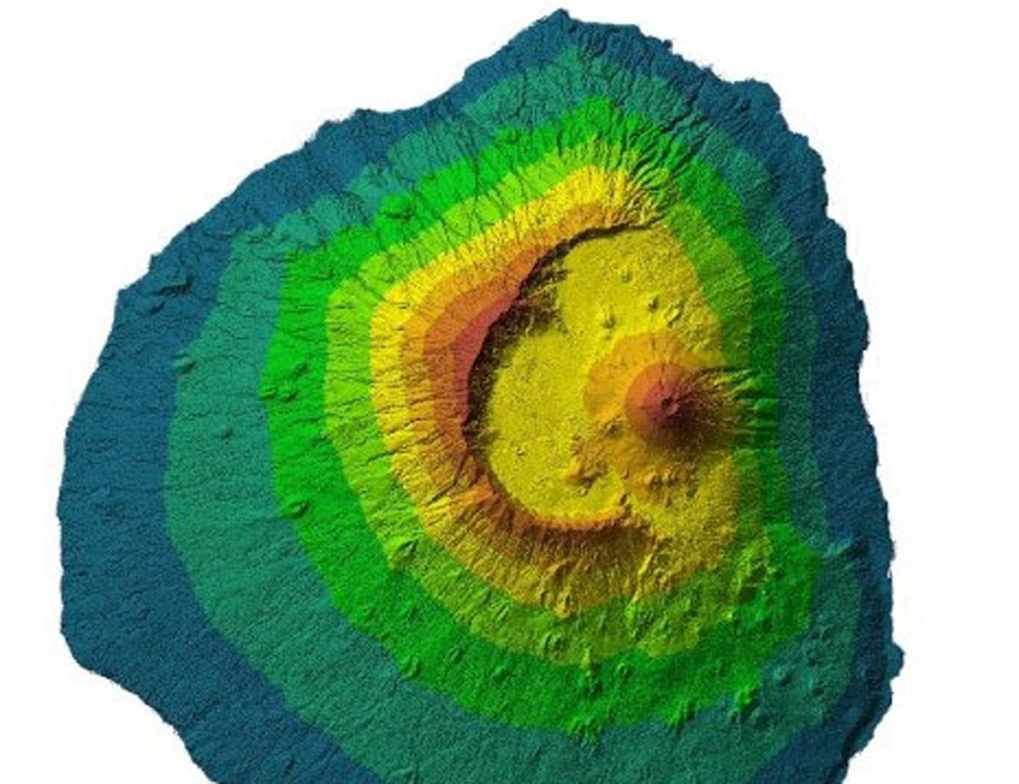
Colour and False Colour orthophotomaps and Certified Cartography
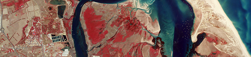
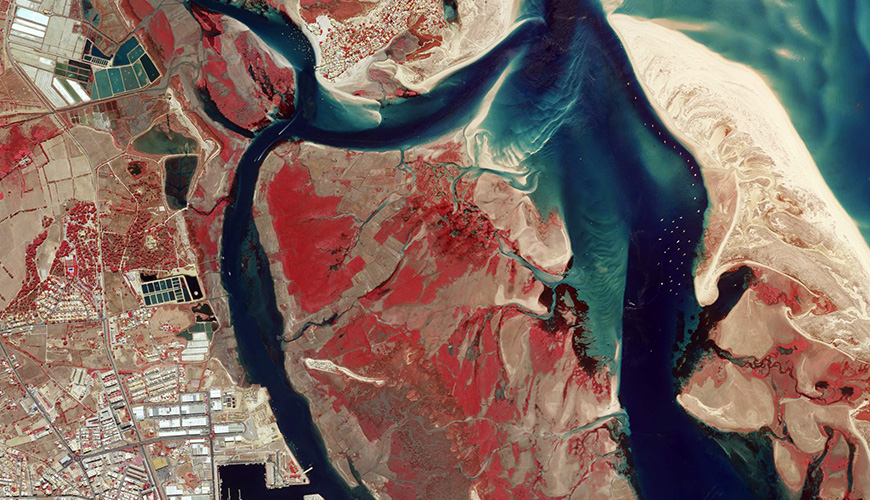
We ensure the immediate interpretation of the territory with direct integration in the GIS.
Characteristics
- Representation of natural and artificial objects on the Earth’s surface, on a given scale, date and projection system.
We produce 3D cartographic bases of quick access and easy interpretation, as well as certified vector cartography through:
2.1 Digital Cartography
We produce maps with thematic information like the relief, hydrography, vegetation, buildings, communication routes, networks and administrative limits, promoting the spatial relationship between these objects. Certification by Public Authorities is always possible.
Our Advantages
- Data acquisition with great accuracy and quality;
- Guarantee of topological consistency and coherence;
- Absence of vector replication;
- Direct integration in GIS (direct acquisition in Data Bases).
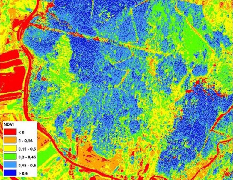
2.2 Orthophotomaps
We provide a visual geographic base, easy to interpret, that support you in the first decisions of territorial management, land recognition and classification.
Our Advantages
- Immediate interpretation of the territory;
- Easy geographical location;
- Qualification of vector cartographic bases;
- Execution of studies by remote detection with great accuracy and high resolution.
Success cases
03.
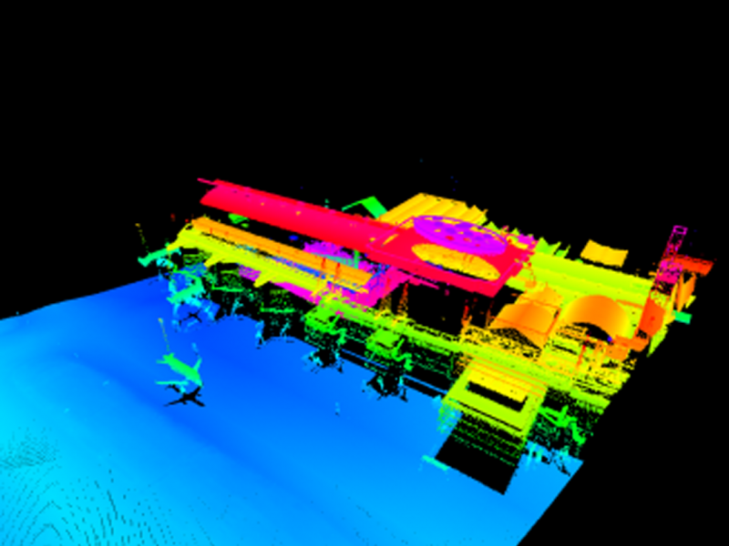
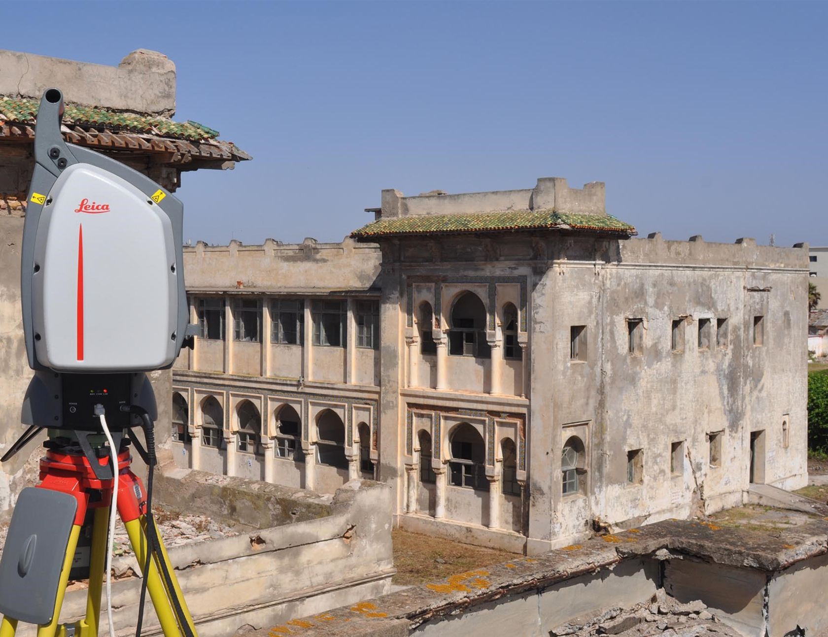
3D Surveys of Structures and Heritage

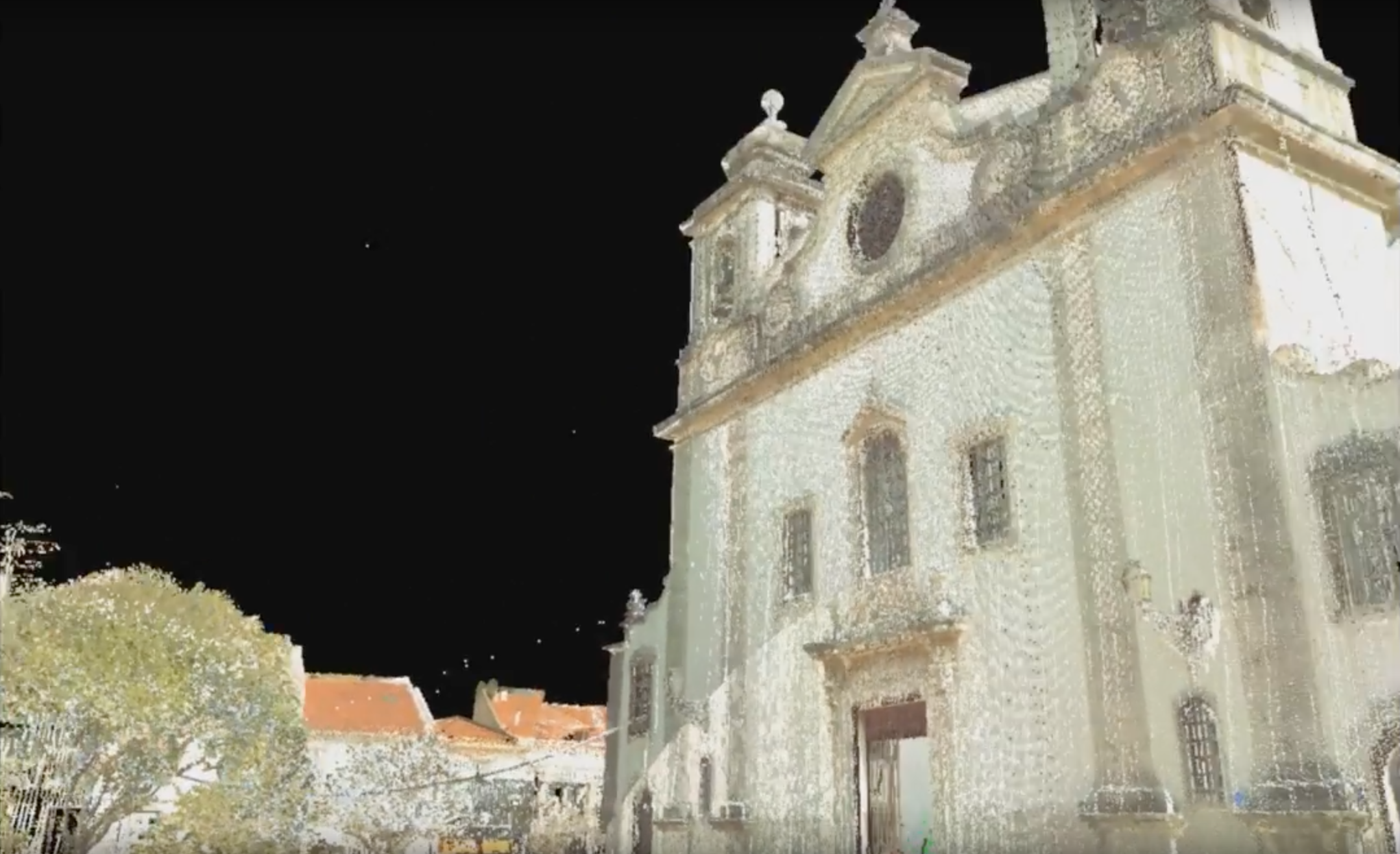
We can quickly and reliably visualize any structure.
We reproduce real 3D models of great quality and detail of structures, buildings, monuments, or works of art without affecting their integrity. The purpose of this technology is to mitigate risk in heritage management, support architectural projects and animate 3D visualizations of a specific area of heritage or architectural interest.
Characteristics
- Capture up to 50,000 pts / second at a distance of 300 meters;
- Millimetre accuracy;
- Production of point clouds x, y, z;
- Production of elevation models and facade orthophotomaps.
Our Advantages
- Security and high productivity in data capture;
- Obtaining a real and high quality 3D model;
- Greater speed compared to other procedures and techniques;
- Diversity of by-products obtained from this technology;
- No need to use auxiliary equipment.
Success cases
Morocco: Interior and exterior survey of 12 buildings for architectural design
International / Public Administration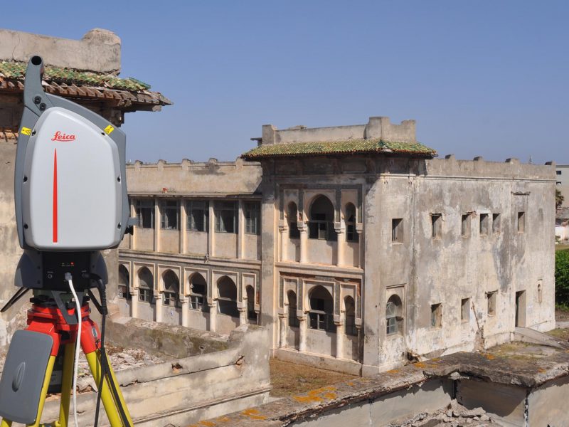
04.
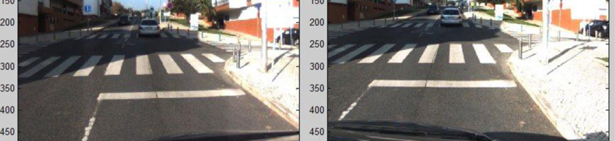
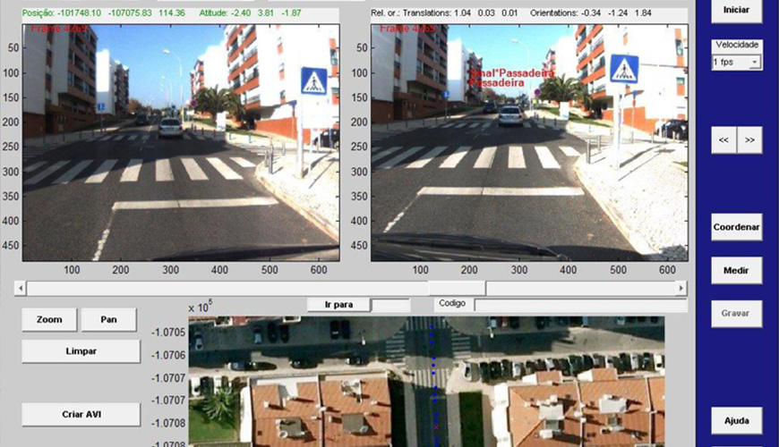
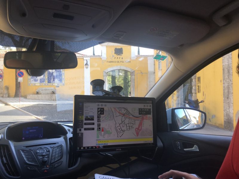
3D Road Network Surveys by Mobile mapping
We guarantee a quick and low-cost survey.
We have a low-cost geographic data acquisition technique, based on sensors installed in a vehicle, allowing video recording and georeferenced laser surveys of the road network and urban furniture.
Our Advantages
- Georeferenced data acquisition using customized object libraries;
- Economy and speed in data acquisition;
- Total coverage of the elements of the Road Network;
- Sectioning of georeferencing depending on immediate needs;
- Agile vision for subsequent acquisitions.
Characteristics
- Georeferenced capture and temporal recording of point clouds and images;
- 360º camera for spherical image capture;
- Characterization of urban equipment and infrastructure;
- Survey of the linear elements that constitute and mark the roads;
- Survey of the punctual elements that equip the street, including vertical signs, Public lighting, advertising, ecopoints, urban furniture, works of art, public transport stops and taxi ranks.
Success cases
05.
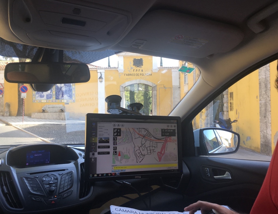
Field Surveys

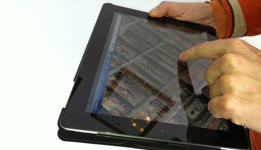
We built a Georeferenced Database for business intelligence analysis, processes and strategies.
The perspective of collecting information for integration and exploration in a Geographic Information environment brings the possibility of searches using geographic criteria and the production of spatial analyses that generate value in fine-tuning management processes.
Characteristics
- Simple and robust mobile applications for acquiring georeferenced data;
- Open source software development to reduce costs;
- Georeferenced digital inventory.
Our Advantages
- Adding the location component to the acquired data, allowing simulations and scenario analysis;
- Customization in relation to the survey target;
- Speed up the survey process by including the location;
- Prevent gaps or loss of information through the use of paper documents;
- Making the data available immediately after the survey;
- Perform the field and office activities simultaneously through the established data communication protocol.
Success cases
06.
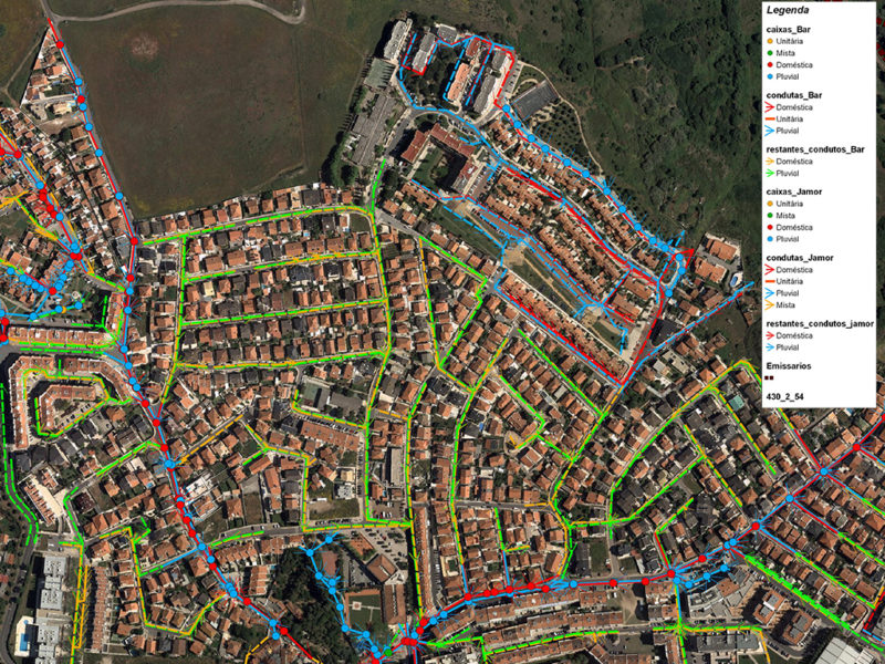
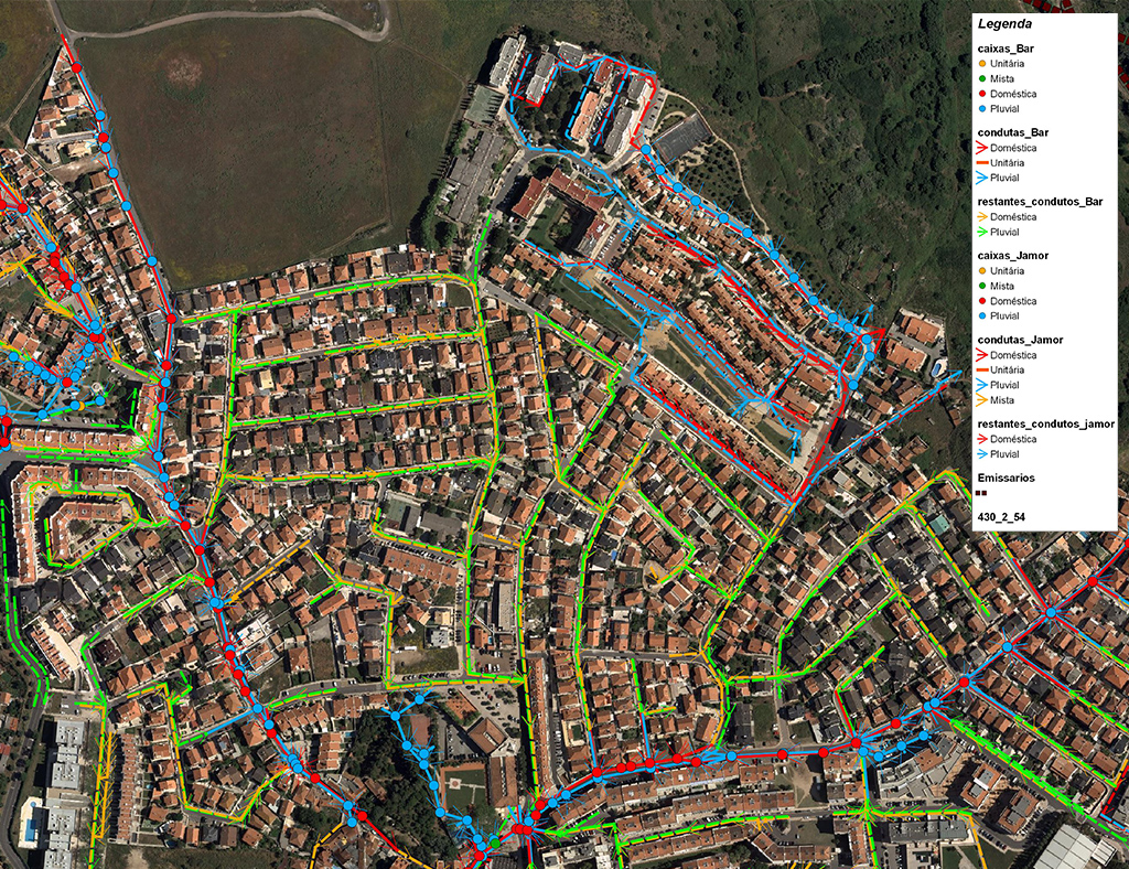
Cadastre of Infrastructure
We identify and solve non-conformities quickly and effectively.
We survey the necessary information for Network Management and Regulation, allowing the identification and resolution of non-conformities, in the shortest time and most surgical construction intervention, the recognition of critical conservation areas, the view of connection points to the supply and treatment stations and the planning of expansion or maintenance investments.
Characteristics
- 3D detection, location and georeferencing;
- Technical and operational characterization of infrastructure systems in the soil and subsoil;
- Design of Data Models customized to the type of infrastructure;
- Multifrequency polling depending on the type of infrastructure.
Our Advantages
- Expand knowledge of infrastructures;
- Reduce costs in correcting anomalies;
- Increase the response capacity of the Public Service;
- Adapt investment plans to the reality of the networks;
- Correct the effectiveness of the Network through spatial, hydrological and statistical analysis of the data;
- Predict breaks by prior identification of places with a lack of inspections, surveys or cleaning.
Success cases
07.
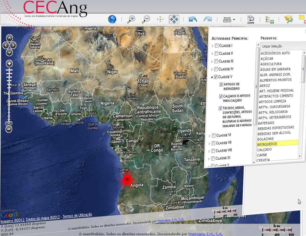
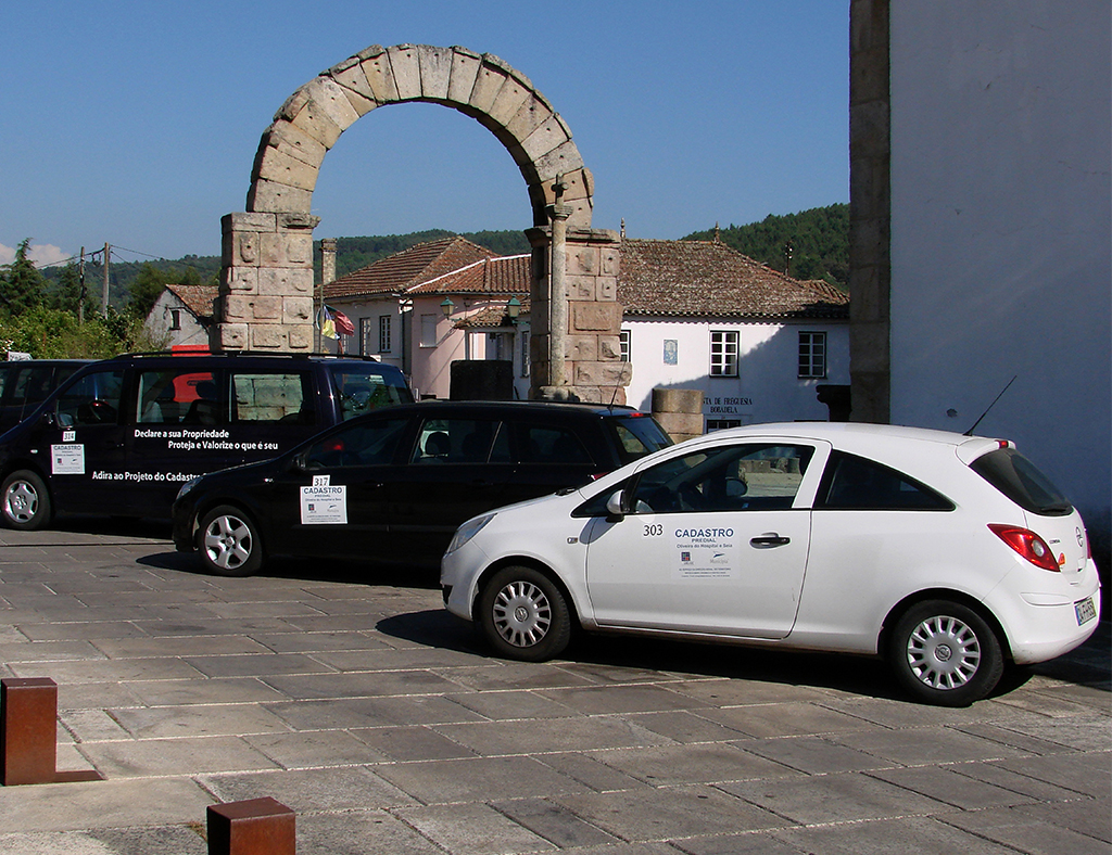
Land Cadastre
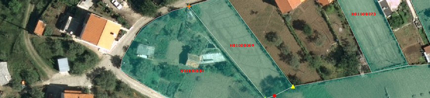
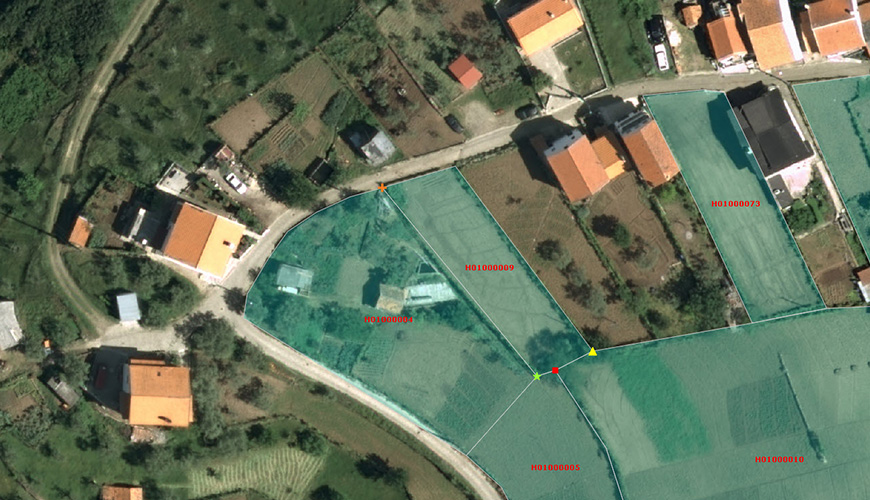
We provide a unique tool for property registry, including land use, environment, economic, tax and public works policies.
Characteristics
- Holistic tool to work the land registry at spatial planning, environment, economic (in particular agricultural and forestry), fiscal and public works policies.
We provide a unique tool for property registry, including land use, environment, economic, tax and public works policies.
We have gathered in a single base of organized and structured information, whose reference unit is the building, the physical, descriptive, legal, tax, valuation and / or devaluation aspects, in order to provide the information support for the actions in the field of Planning and Territory Management.
Characteristics
- Holistic tool to work the land registry at spatial planning, environment, economic (in particular agricultural and forestry), fiscal and public works policies.
We have gathered in a single base of organized and structured information, whose reference unit is the building, the physical, descriptive, legal, tax, valuation and / or devaluation aspects, in order to provide the information support for the actions in the field of Planning and Territory Management.
Our Advantages
- Accurate data acquisition with quality control;
- Integration of processes since the first step;
- Guarantee of unicity;
- Availability of unique information by the different Entities involved;
- Efficiency in the project due to the global communication between our own GPS survey teams, the service offices and the platform management.
Success cases
Cape Verde – São Vicente Island: Systematic clarification of rights and regularization of property limits
International / Public Administration

08.
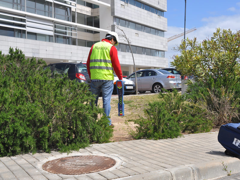
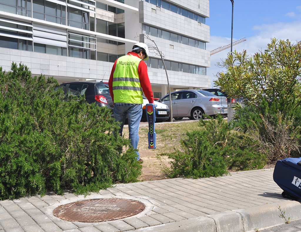
Infrastructure Detection and Inspection
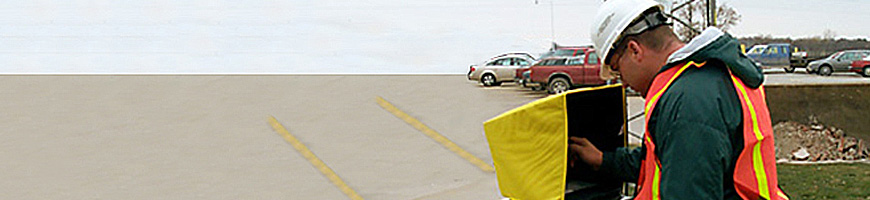
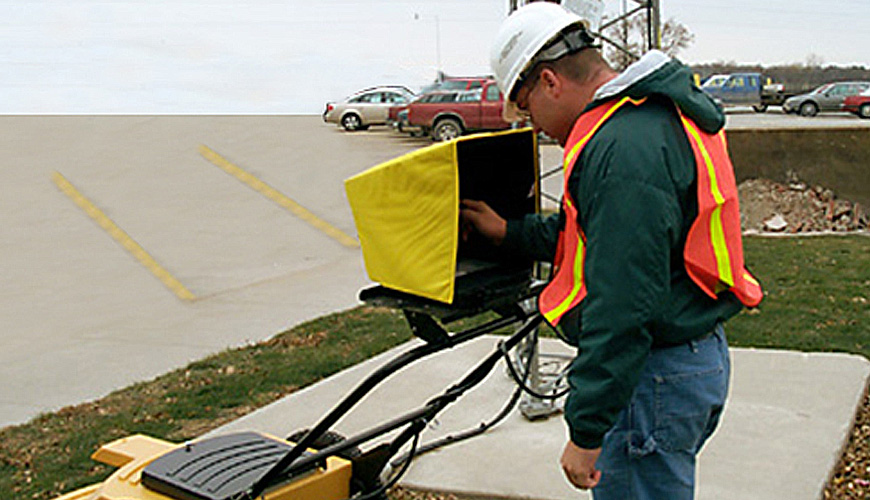
We detect and locate infrastructures of underground networks.
We carry out the survey of cable paths and ductwork in the underground for several purposes. This service aims to support excavation works and underground interventions, detailed and special sectoral plans, cadastral surveys of infrastructure and underground planning and ordering, as well as emergency plans.
Characteristics
- Survey of infrastructures for projects or plans;
- Production of network records;
- Data production for integration in the customer’s existing cadastre;
- Identification in the field and labelling the connection points with origin / destination information;
- Possibility of printing location plans to monitor underground interventions;
- Monitoring excavation works.
Our Advantages
- Obtaining depths;
- High precision GPS;
- Differentiation of types of networks (sanitation ducts, electrical cables, among others);
- Possibility of isolated detection of electrical cables or metallic telecommunications cables;
- Reduction of risk of rupture and other damage to infrastructure;
- Minimization of accidents in excavation works;
- Rigorous knowledge of the infrastructures present in the basement.
Success cases
09.
Heritage +


We analyse which is the best survey solution for your project.
We are certified leaders in this sector, both in handling and registering the work pieces. Only by this way can we guarantee the quality of our results.
Functionalities
- Digital survey – All the characteristics of the pieces are kept accurately;
- Virtual Museum – Enhancement of digital media by sampling pieces on the web;
- Education – Bringing knowledge to schools;
- Exhibition and promotion – Construction of 3D replicas;
- Accessibility – Creation of tactile models for easy access for all;
- Conservation – Rehabilitation and refurbishment, by making their survey available.
Our Advantages
- Improve research and conservation processes;
- Guarantee content for online channels or new digital interaction tools;
- Conduct the licensing of digital copies for museums;
- Guarantee public presentation and involvement actions;
- Create appealing merchandising;
- Make the archive of digital collections in 3D format;
- Monitor the evolution of the condition of the parts over time by creating actions that can control their degradation;
- Improve visual perception in the scope of rehabilitation and refurbishment, by making its collection available.