


Application Development
01.
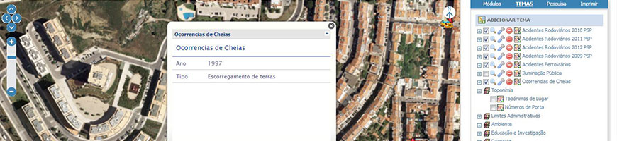
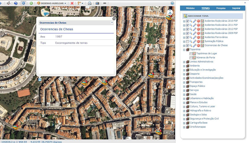
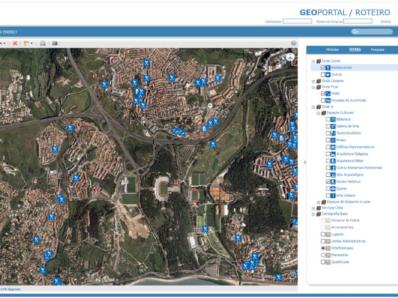
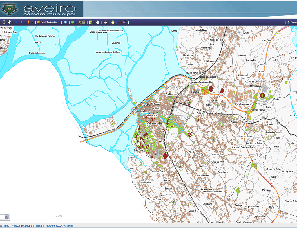
GeoPortal
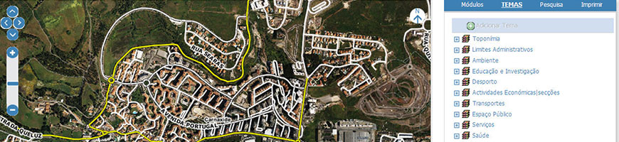
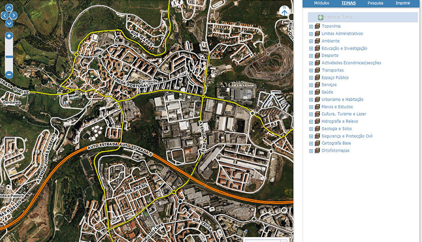
We analyse the best way to disseminate the geographical data of your entity in an Intranet and Internet environment.
Through the GeoPortal, we streamline the centralization and management of Intranet and Internet users’ to access to all information available in the Geographic Information System. Based on CMS technology, this tool allows you to create and organize content, manipulate appearance, automate administrative tasks, and define permissions and roles for users and employees.
Functionalities
- Centralized access to Maps and Geographic Data;
- Share Meta-Information;
- Share Geographic Information Web Services;
- Availability of Documents and Legislation;
- Disclosure of news and events;
- Contacts page
Success cases
02.
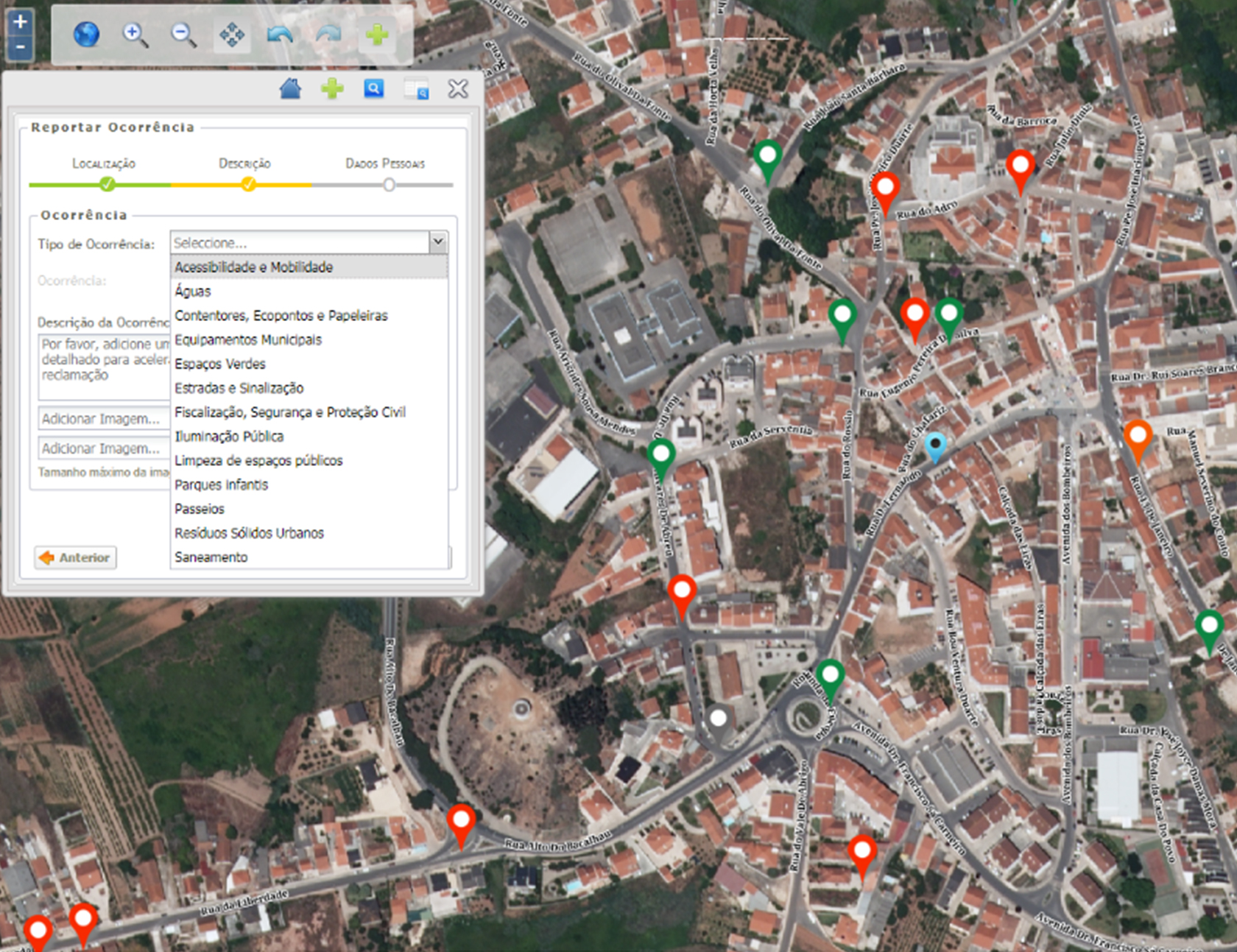
My Street
We support the active participation of citizens in the management of their municipality.
We developed a simple and intuitive application to citizen’s communications with map support. The fields are configurable, with mandatory and optional responses, allowing the streamlining and simplification of procedures, increasing transparency in the relationship between the municipality and the citizen.
Functionalities
- Registration and routing events;
- Classifying occurrence by type;
- Registration and change of the occurrence status;
- Occurrence search;
- Warning system.
Success cases
Development and Implementation of an Occurrence Management Application on the Street
Public Administration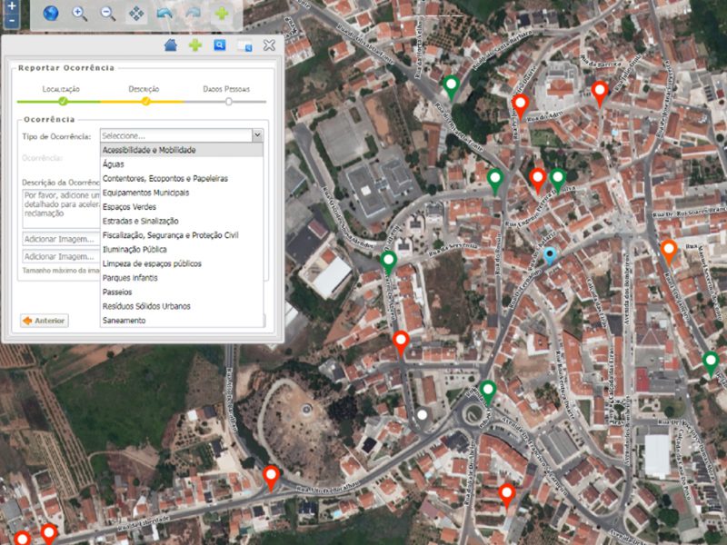
03.
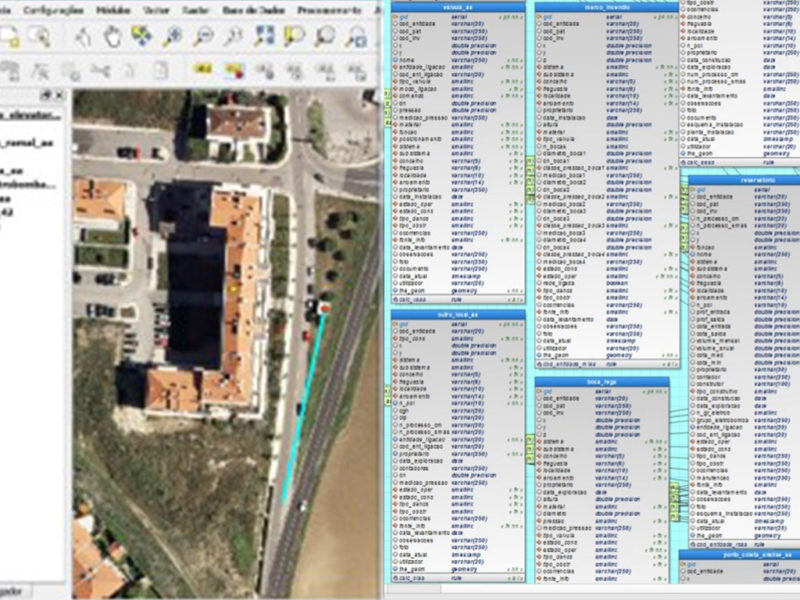
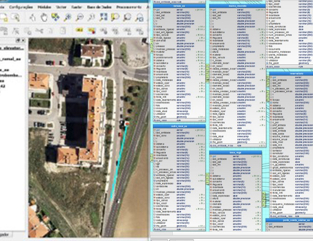
Network management


We combine the management of several networks on a single geographic base.
We provide a base tool for the management of infrastructure networks, whether water, sewage or telecommunications, in a map-based concept and on through the interconnection with the services to be provided.
Functionalities
- Manage one or more types of infrastructure;
- Searches for specific information of network elements / bodies;
- Issuance of specific listings and reports according to the cadastre elements;
- Possibility of integration with other systems, namely:
- Customer management / invoicing;
- Service orders;
- Customer support and call centre service;
- Design and modelling applications.
Success cases
04.
Municipal Operations Center
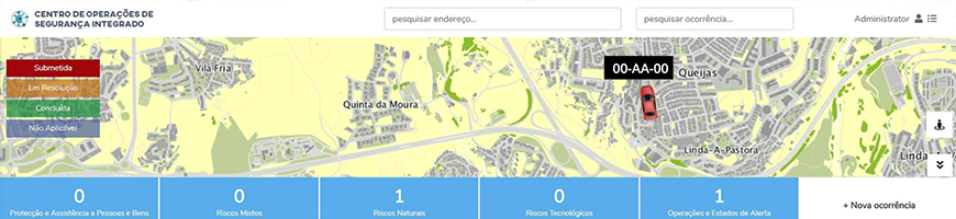
Designed to support the activities of the municipal operational command center.
Get efficient management of the municipality’s security services. Through this application you can, in real time, monitor the fleet, agents, patrols and manage all occurrences.
Functionalities
- Creation and management of occurrences of the Municipal Police and Civil Protection, namely, registration of emergency situations, alarms, proximity policing, inspection and communication actions;
- Management of agents, shifts and patrols;
- Real time visualization of vehicles with GPS and radios;
- Visualization of the occurrence time tape and daily time tape;
- Viewing and extracting the event reports and daily activity report.
Success cases
Sorry, no posts matched your criteria.
05.
Work Order Management
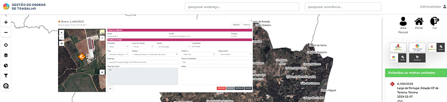
We focus the management of team work in a single application.
We present this application that allows you to manage work orders in a mobile and web environment, ensuring order management with maximum efficiency, ensuring effective communication and optimizing team travel.
Functionalities
- Allows the management of the organization’s internal orders;
- Workflow implementation;
- Process automation;
- Remote sending of work orders to the mobile devices of the
field teams; - Integration with routing application to navigate to the next work order;
- Validation of requests using photographs and response to form;
- The application’s dashboard allows you to view the types of requests, response times and number of requests per user;
- Integration with the “My Street” application.
.
Success cases
Sorry, no posts matched your criteria.
06.
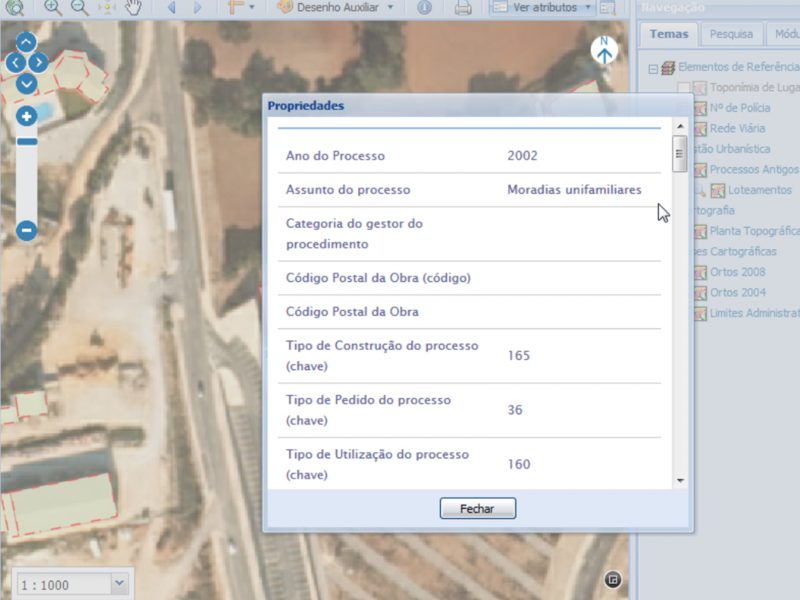
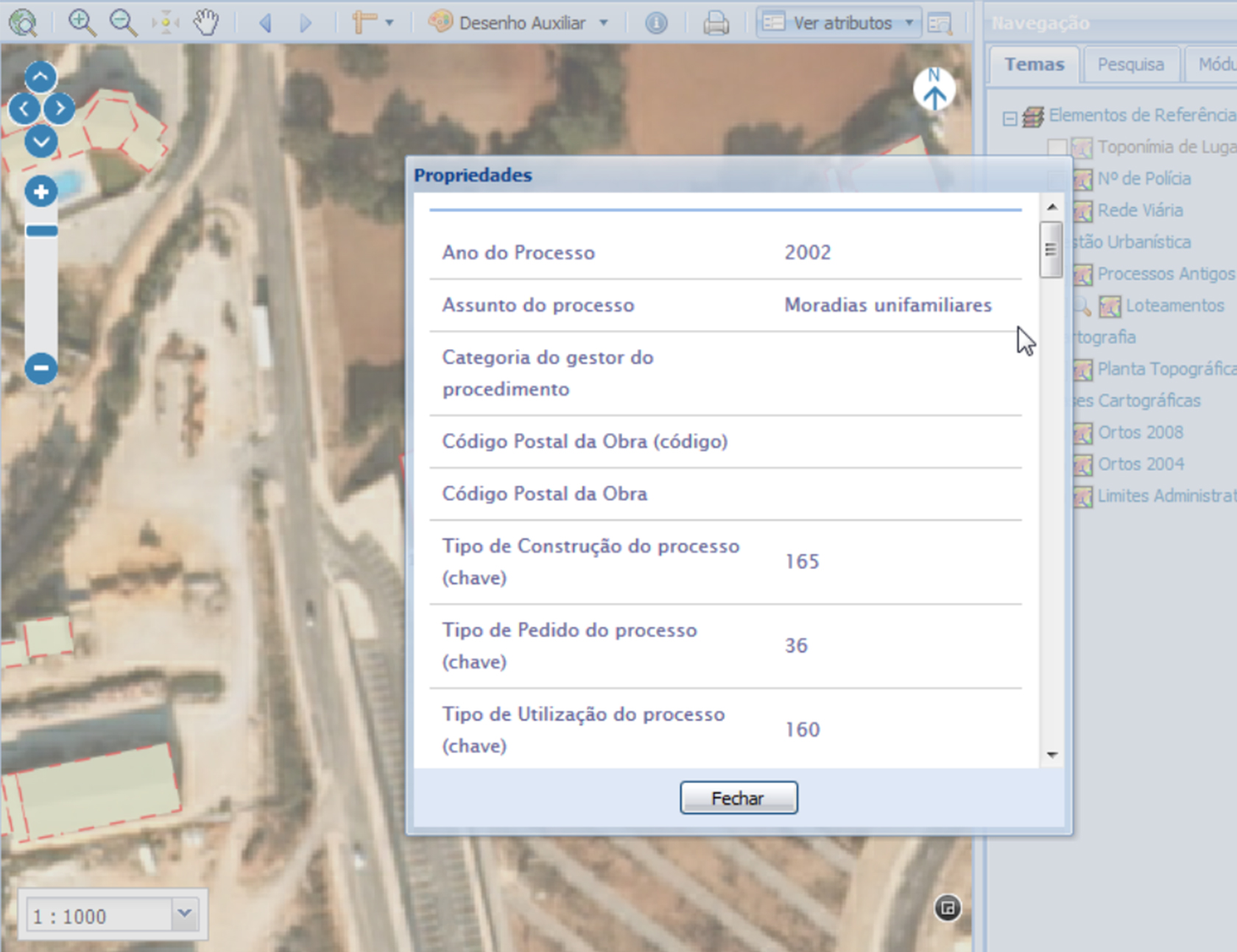
Urban Management
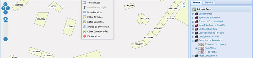
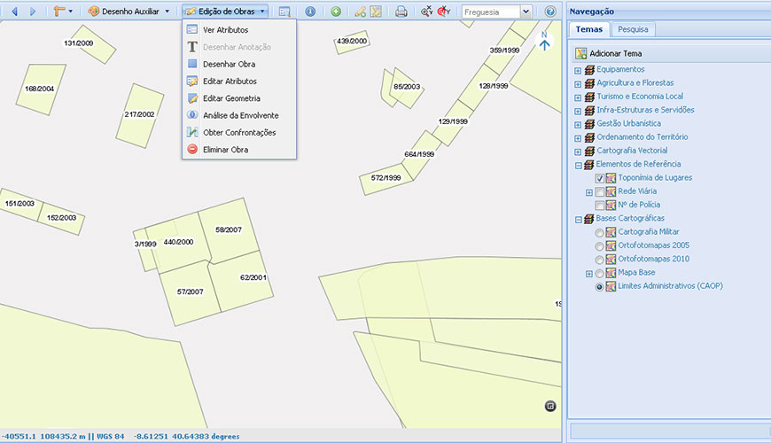
We support the instruction of the licensing procedures for urban operations.
We developed an application that supports you in urban management activities, through the verification of legislation and regulations in force.
Functionalities
- Visualization of Territorial Management instruments;
- Consultation of rules, laws and associated documents;
- Registration of construction claims;
- Automatic confrontation with the Territorial Management instruments;
- Analysis of surrounding options;
- Issuance of reports based on the intended claim;
- Aggregation of external requests to the classes of space or restrictions;
- Georeferencing of processes;
- Statistical evaluation of indicators.
Success cases
07.
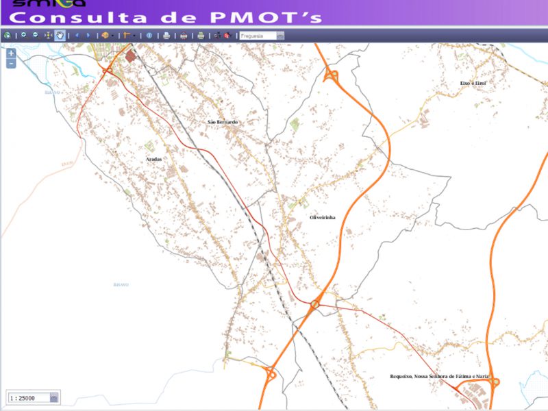
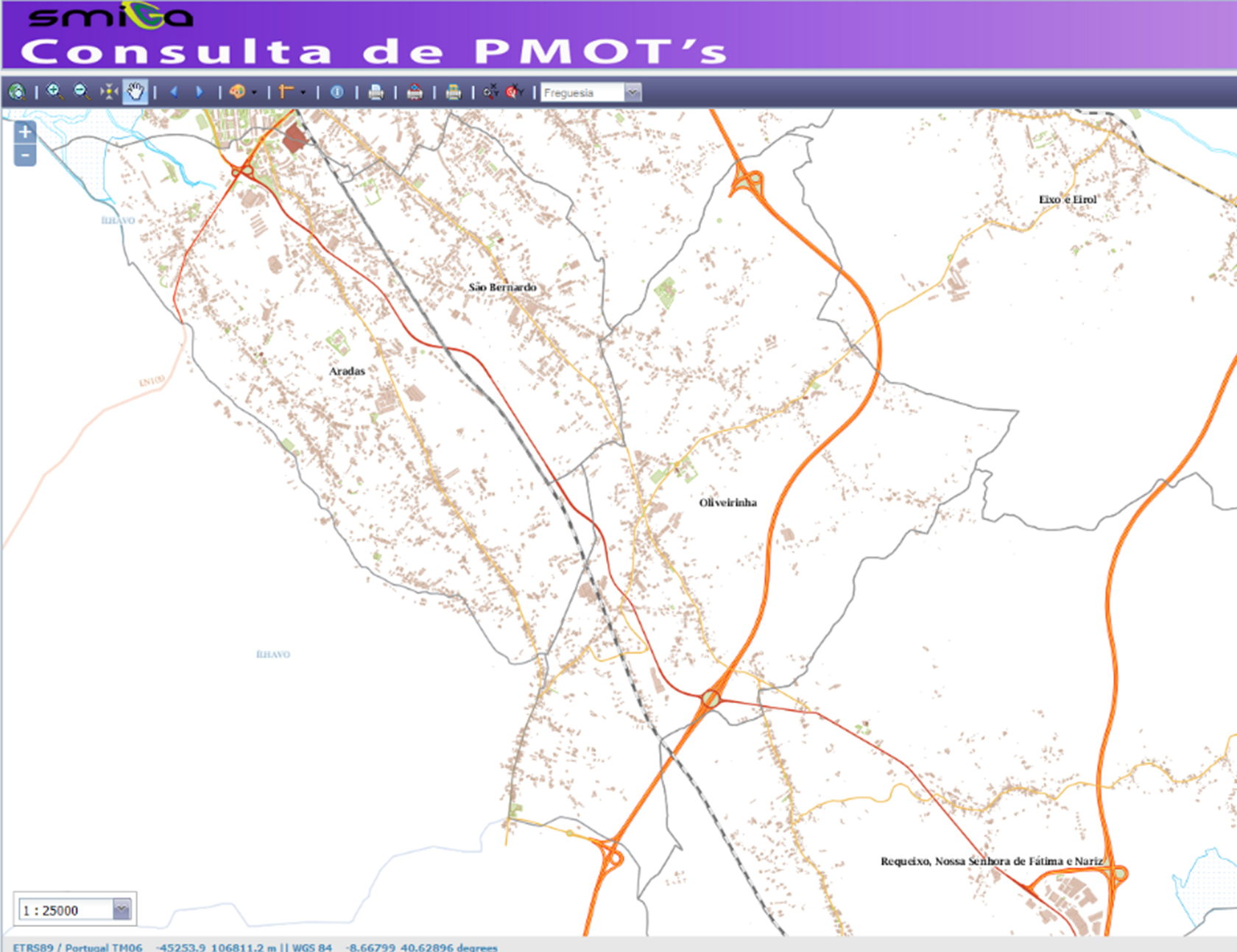
Consultation to the PDM (Municipal Director Plans)
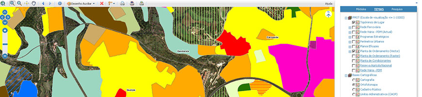
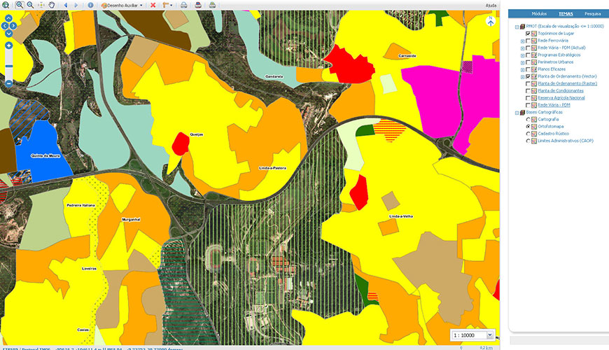
In a simple and immediate way this application makes available all the plans and respective regulations for consultation.
This application makes possible to perform a previous consultation to the PDM, having as a starting point a certain location in the territory, a rustic parcel and / or an address. After identifying the location of the claim, it is possible to crosscheck this information with the space classes, with the regulations and conditions of the PDM and print the information resulting from this analysis, serving as a first estimate to the feasibility of transforming the territory.
Functionalities
- Search by place name;
- Address search;
- Searches of space classes;
- Consultation of the regulation;
- Free printing of the information visible on the map;
- Drawing of the claim;
- Issuing a request for simple information from the geographical location of the claim;
- Free printing of the plans.
Success cases
08.
Location Plans
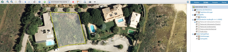
We simplify the availability of different plants
We developed this application to provide the Municipalities with an automated printing tool of the location plans necessary for the instruction of the works and subdivision processes according to the type of process.
Functionalities
- Search by place names and addresses;
- Free printing of the information visible on the map;
- Pretension drawing;
- Emission of plants by type of process and geographic location of the claim;
- Order management..
Success cases
Sorry, no posts matched your criteria.
09.
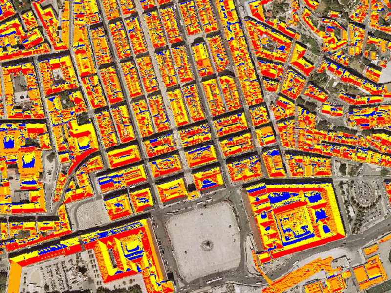
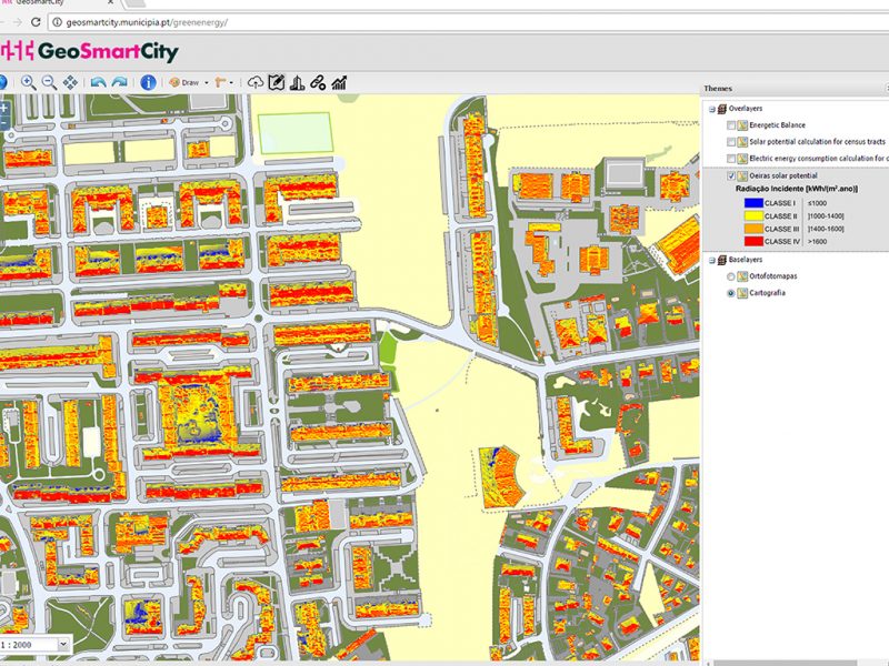
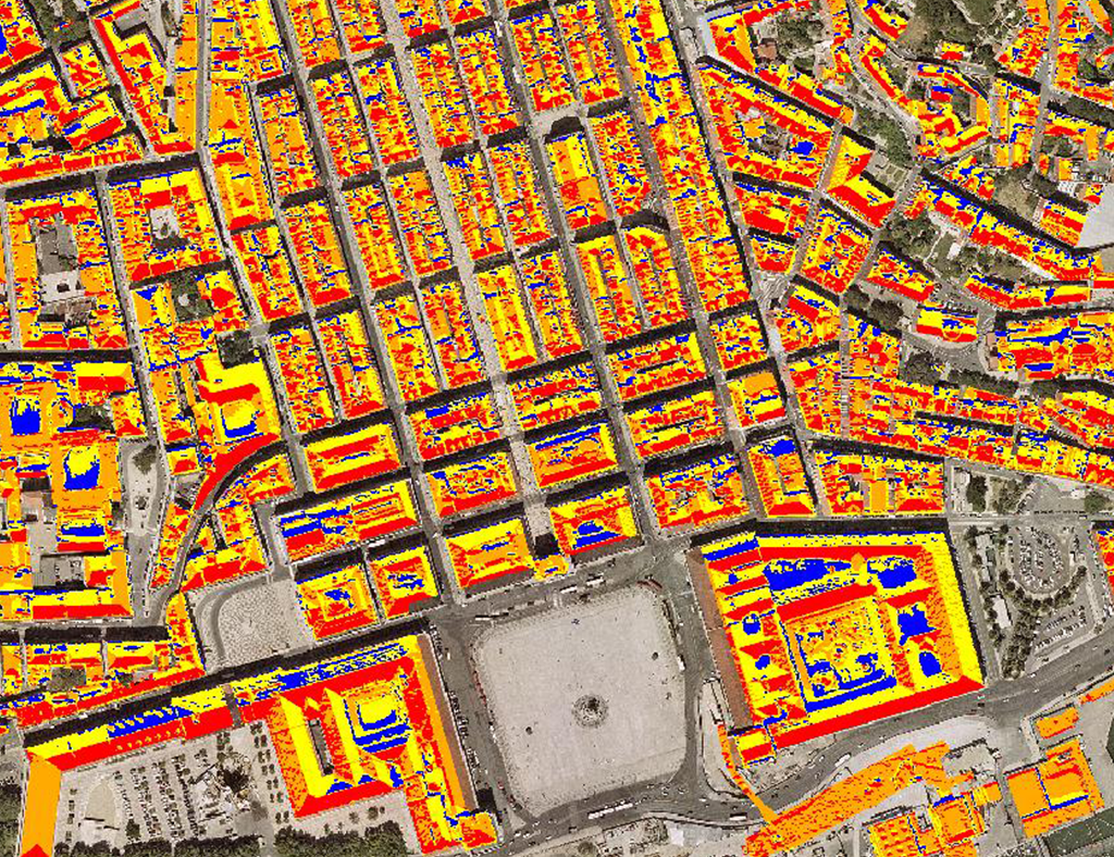
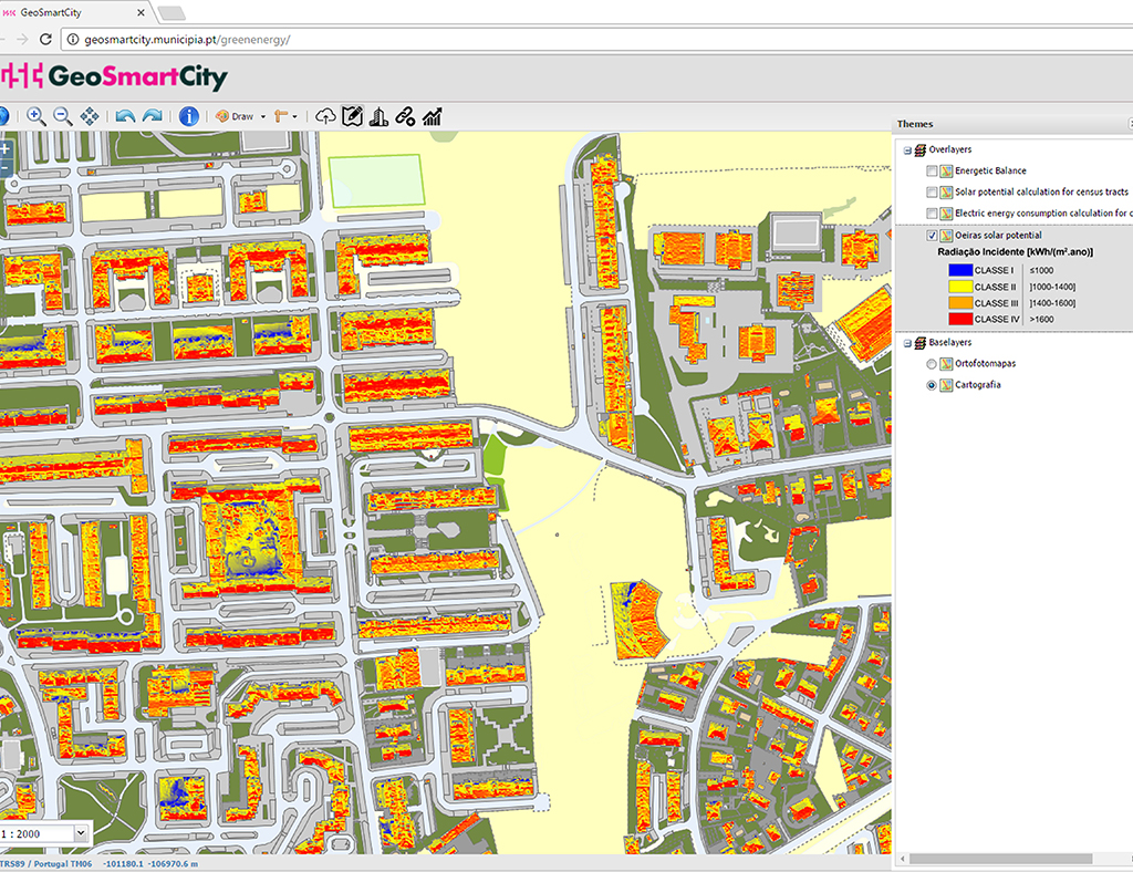
Solar Potential
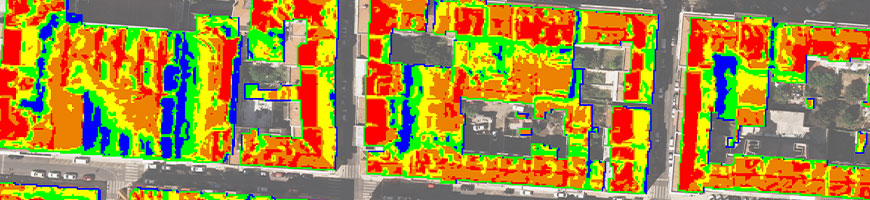
We identify the best roofs to use Solar Technologies.
We integrate the data from the solar potential of the roofs of your Municipality with the electricity consumption data of each client and estimate the optimal photovoltaic solution for your citizen, in a mobile application, accessible to everyone.
Functionalities
- Application adapted to mobile devices;
- Solar potential map as a base;
- Indication of the optimal solution for harvesting energy;
- Estimation of consumption, production, investment and return;
- Search by address and click on the map.
Success cases
10.
Green Spaces and Tree Cadastre
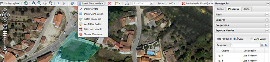
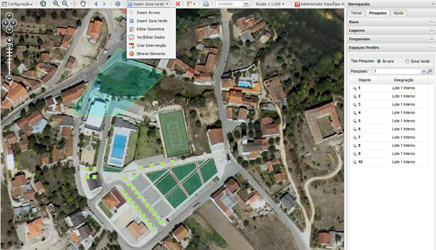
We optimize the use of green spaces and the maintenance of trees.
We present qualified solutions for the management of green spaces and the tree cadastre, namely at the level of the inventory and respective assessment, planning and operations management.
Functionalities
- Inventory, consisting of a graphic aspect, with the location of all the green spaces inventoried and text fields with a detailed description of each of these areas;
- Evaluation of all the data in the inventory, with the generation of sanitary reports to assist the planning and the necessary interventions;
- Management component, which allows to store all the planned and executed activities, in terms of seed planting, arrangements, transplants and treatments, allowing an easy consultation of these interventions through the creation of field files
Success cases
Sorry, no posts matched your criteria.
11.
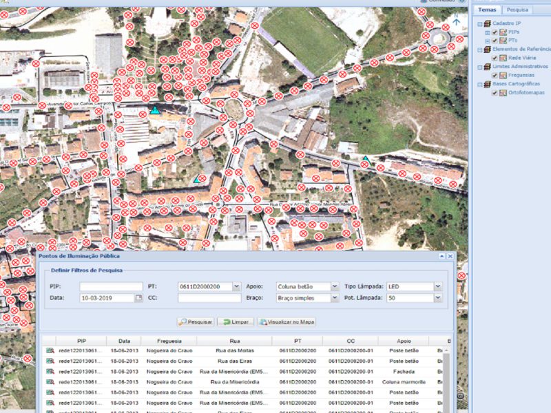
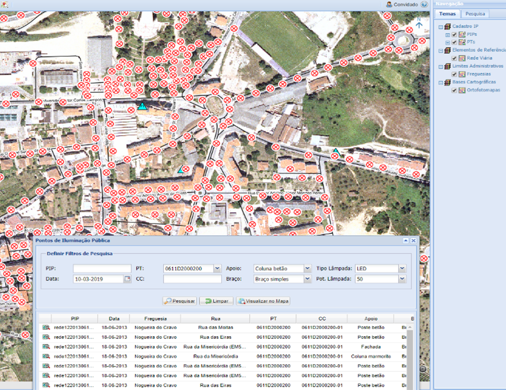
Public Lighting Network


We concentrate the management of the entire public lighting network on a single spatial basis.
Betting on an application like this, with a spatial component, will allow you to establish actions by priority in accordance with the places of greatest inefficiency and with the impacts of the measures on different types of land occupation.
Functionalities
- Cadastre and management of the public lighting network:
- Lightning points;
- Cabinets and circuits;
- Transformation sites;
- Search for information on the public lighting network;
- Issuance of reports:
- Circuits and designation;
- Cabinets and circuits;
- Pontos de iluminação;
- Columns;
- Lamps;
- Location of circuits with higher consumption;
- Issuing of location plans.
Success cases
12.
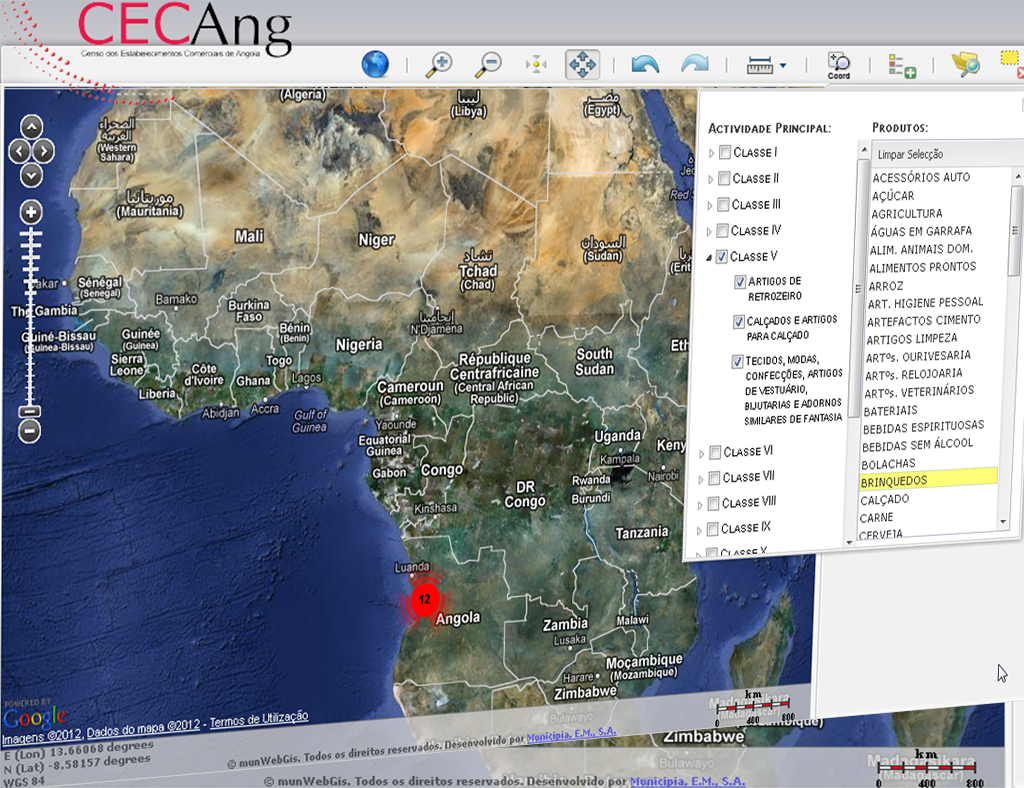
Statistical Maps
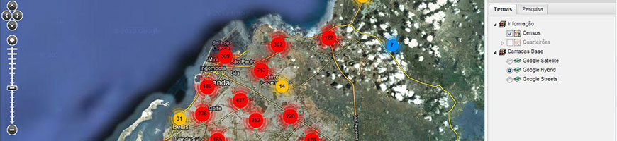
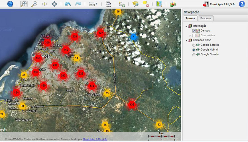
We draw maps according to your project.
We support the mapping of statistical information, with features to search for information related to a specific geographical area, to produce thematic maps tailored to each user and summary tables of statistical information, allowing the printing of these documents.
Functionalities
- Identification of Entities;
- Statistical Information Search by Administrative Division or by Statistical Variable;
- Production of Thematic Maps:
- Possibility to edit the color palette;
- Definition of the number of classes;
- Printing of Thematic Maps;
- Export to Excel;
- Configuration printing.
Success cases
13.
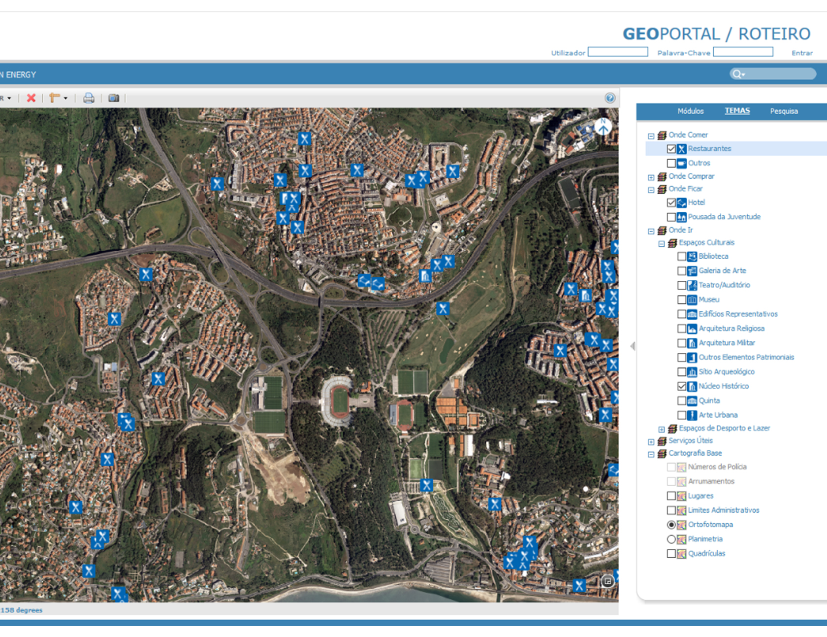
Municipal Tourist Guide
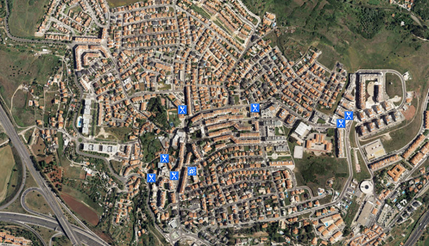
We provide a virtual visit to your Municipality.
We provide a communication, tourist and economic tool, which will highlight the local competitive advantages of your Municipality, through attributes or using spatial criteria.
Functionalities
- Search by place name;
- Address search;
- Free printing of the information visible on the map;
- Search for Points of Interest;
- Consultation of Information associated with Points of Interest;
- Proximity search
Success cases
14.
Toponymy

We provide a simple and intuitive interface for producing and providing up-to-date information about street names and door numbers.
We bring to the services a management tool for generating street names and door numbers and the possibility of simultaneously providing this updated information in real time for other applications.
Functionalities
- Door numbers management;
- Management of street names;
- Search by place name;
- Address search;
- Map printing for field work;
- Certificate of toponymy.
15.
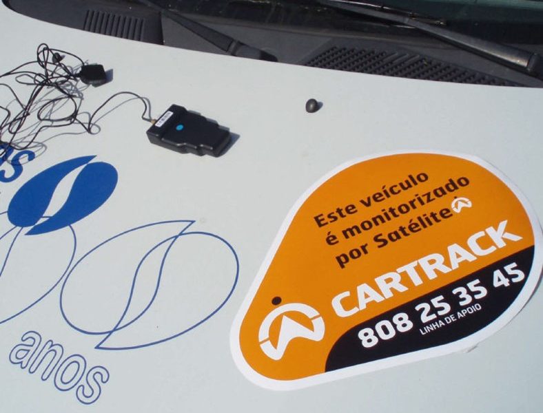
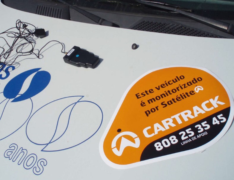
Fleet management

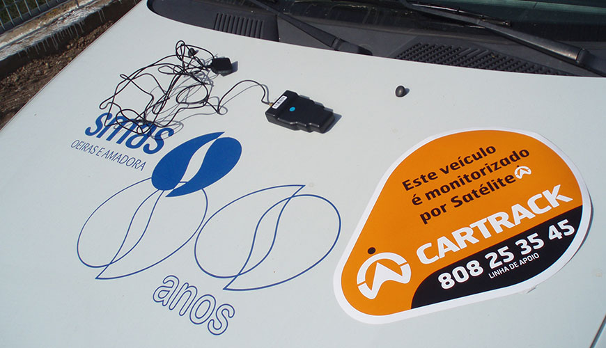
Would you like to be informed automatically where your vehicles are and what is their status? or whenever a vehicle leaves your area of action or exceeds a certain speed?
Achieve an efficient and real-time management of your entire fleet, through the updated views of the position and routes of the vehicles. You have the possibility to access alerts and reports providing reliable data on routes, speeds, mileage and driver profiles, allowing you to forecast expenses, consumption and plan routes in order to make them as efficient as possible.
Functionalities
- Real-time location of the vehicle and the fleet;
- Access to an extensive list of reports on vehicles and / or drivers;
- Possibility to define alerts on the activities of vehicles and / or drivers;
- Define zones that are more sensitive to the entity, knowing immediately an information about entries / exits and length of stay in these same areas, which are unlimited;
- Possibility to identify the driver;
- Integration of the fuel measurement module;
- Storage of the last five years history.