


Plans and Studies
01.
Municipal Emergency Plans
We optimize your response to emergencies.
We are aware that the implications resulting from emergencies, whether in relation to human, environmental or economic damage, are increasingly high and tend to be higher.
In this way, we actively implement emergency plans where prevention is the key.
Characteristics
- Apply local/national laws;
- Identify and locate equipment, means and resources;
- Identify and locate hazards, vulnerabilities and risks;
- Mitigate and reduce disaster risk factors;
- Define emergency action procedures and decisions to be taken in order to deal with the disaster;
- Predict the responsibilities and competences of each actor involved;
- Identify protocols and agreements with existing sector plans.
Our Advantages
- Advanced technology;
- Preparation in a GIS environment;
- Availability in an internet environment;
- Fast and universal access;
- Faster analysis of hazards and vulnerability;
- Decision on the most appropriate response strategies.
Success cases
02.
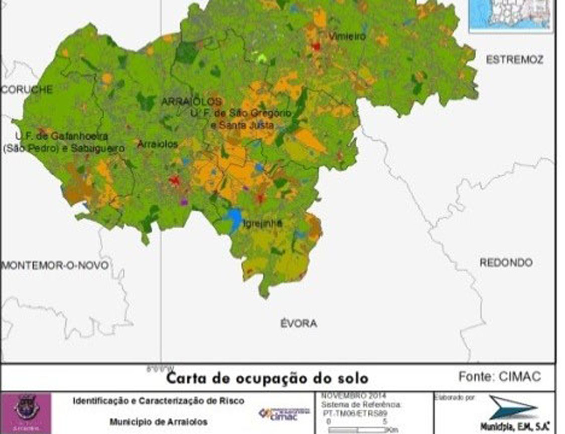
Land Use Scenarios
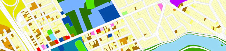
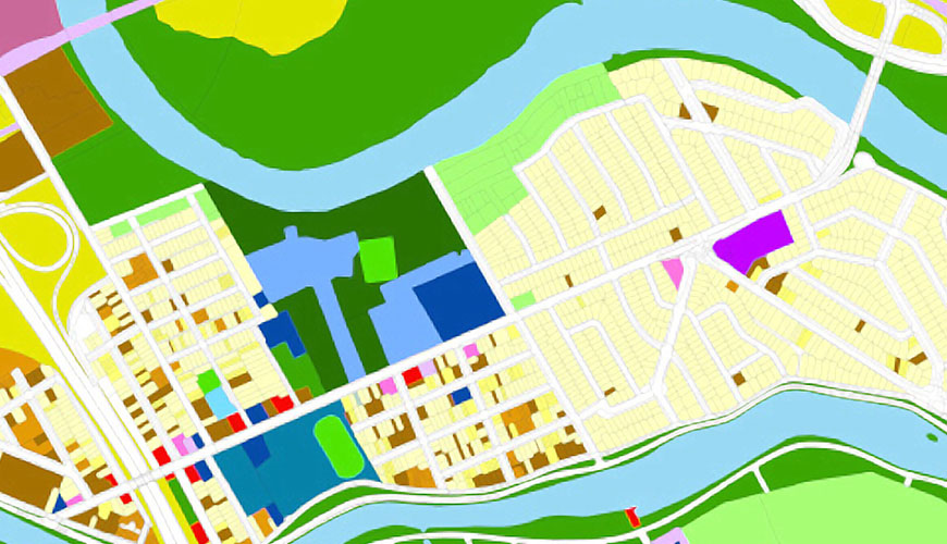
We guide you towards better decision-making and management.
Good management of the territory requires a deep knowledge of its occupation. Knowing the past and present of the territory may be the starting point, but envisioning the future may be the key to the territory’s sustainability at the social, economic, environmental and infrastructural dimensions.
Characteristics
- Retrospective analysis of the evolution of land use for two moments (past and present);
- Mapping of the most susceptible areas to soil use changing;
- Cartography of future land occupation (scenario modelling).
Our Advantages
- We account the evolution of each class of land use, cartographically and statistically;
- We provide the decision maker with the location and statistical information of the classes that will face the most dynamics;
- We infer the places of greatest conflict and greatest potential in the territory.
Success cases
Sorry, no posts matched your criteria.
03.
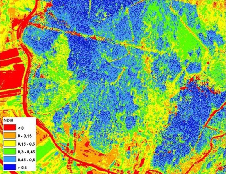
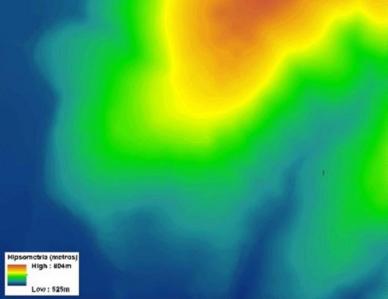
Representative maps of the Vegetation Index and Physiography
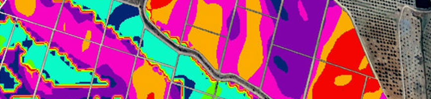
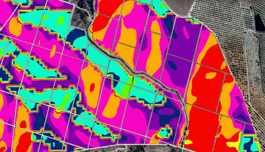
We use techniques and methods based on Precision Agriculture to help in the achievement of the best product at the lower operation costs.
We use remote sensing techniques based on crop aerial images to map the state of the plantations with high resolution. The result is the transmission of knowledge to the farmer; in order him to take the most conscious measures in the harvest and in the management of vineyards, olive, fruit and other annual crops.
Characteristics
- Aerial imagery performed by certified aerial means to produce quality data;
- Flights performed in correspondence to the state of the crops;
- Production of orthophotomaps with great accuracy;
- Application of vegetation indices, terrain modelling and solar radiation calculations;
- Integration in a Geographic Information System environment;
- Delimitation of parcels and zones.
Our Advantages
- Rapid information production to support farmers at the harvesting most stressing time;
- Great accuracy;
- Low cost;
- Integration in GIS;
- Quick visualization of the most vigorous areas;
- Multiannual analysis.
Success cases
04.
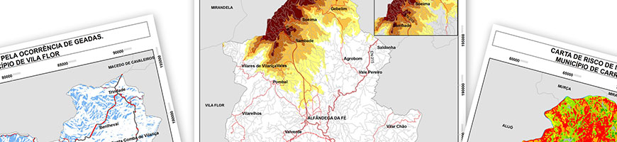
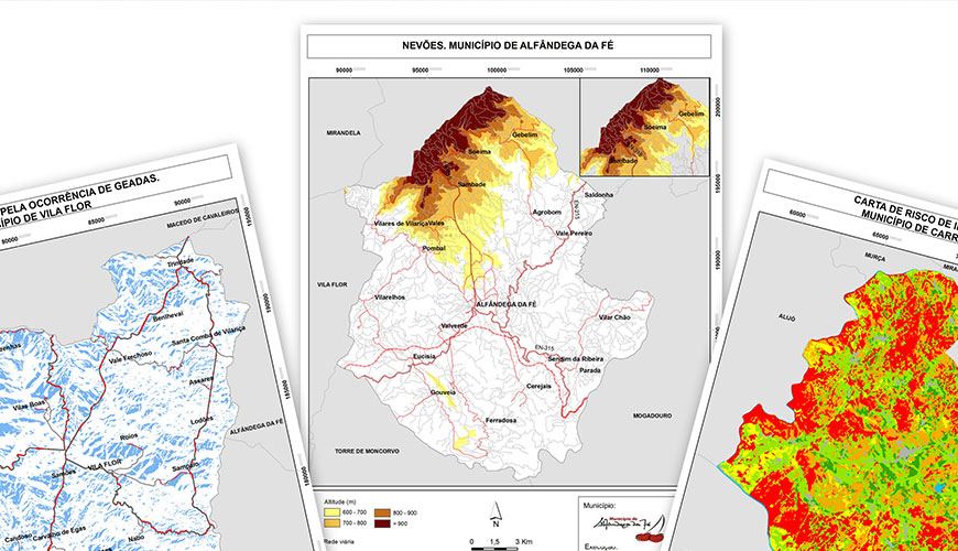
Risk Maps
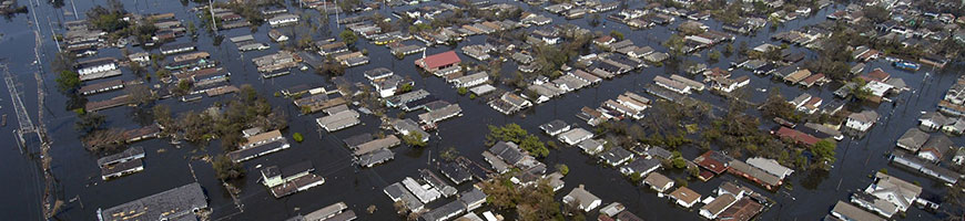
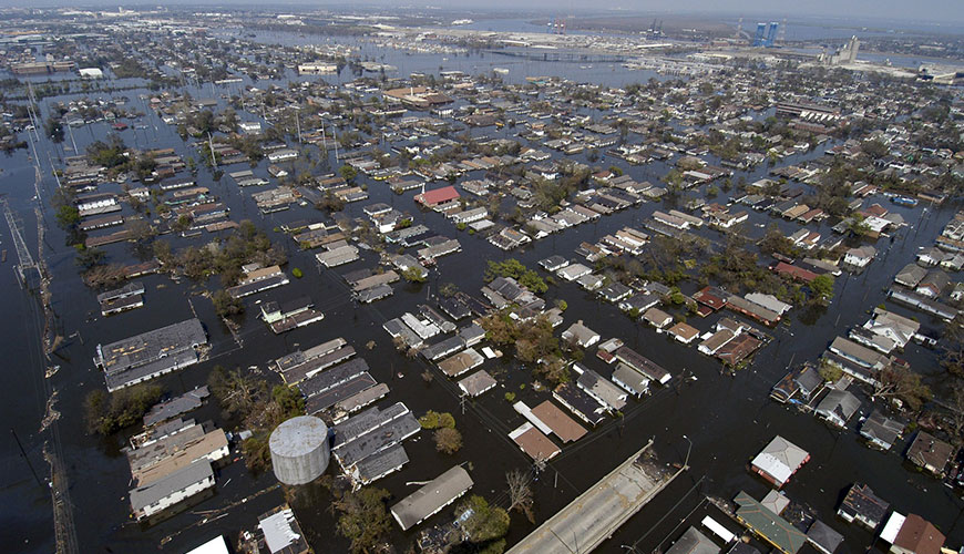
We produce maps of danger, vulnerability and susceptibility.
Floods are one of the examples with consequences resulting from a natural phenomenon that we have not been able to avoid. However, we can mitigate them through measures such as the elaboration of hydrological and hydraulic studies, which allows accurate mapping of the most dangerous areas. Like floods, there are forest fires, landslides, coastal erosion, volcanism, or other risks such as epidemics that we can assess.
Characteristics
- LIDAR surveys;
- Survey and cadastre of infrastructures;
- Survey of soil singularities, vegetation cover and waterproofing;
- Hydrological and hydraulic studies;
- Study of meteorological behaviour;
- Identification of external factors contributing to the problem;
- Implementation of monitoring and control systems (instrumentation);
- Simulation of scenarios.
Our Advantages
- Very short acquisition times;
- Density measurements higher than any traditional acquisition method;
- Possibility brought to the simulation programs for carrying out analyses on floodable surfaces without being limited to a set of sections;
- Use of robust hydraulic models that operate on Geographic Information Systems technologies.
Success cases

05.
Soil apparent Electrical Conductivity Mapping
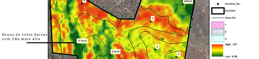
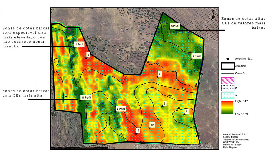
We evaluate your parcel effectively.
The most effective way to assess variability in a parcel is by mapping its Apparent Electrical Conductivity (CEa). This assessment will give you information about the parcel, from the variation in soil texture to the identification of problem areas, which allows the farmer to define specific management strategies in a precise and differentiated way.
Characteristics
- Survey using a specific sensor, carried out without direct contact with the ground;
- Preservation of soil characteristic;
- Measurements up to 1 m in depth.
Our Advantages
- Personalized decision support when installing crops;
- Implementation of the irrigation system, namely the delimitation of sectors;
- Soil corrections and fertilizations;
- Choice of varieties and their location;
- Assess the feasibility of installing the crop in some areas of the parcel;
- Identification of critical areas for sampling or definition of monitoring sites;
- Production of comparative maps such as expected / obtained productivity or between campaigns;
- Relevant data to differentiate irrigation calculations (VRI pivot, irrigation sectors).
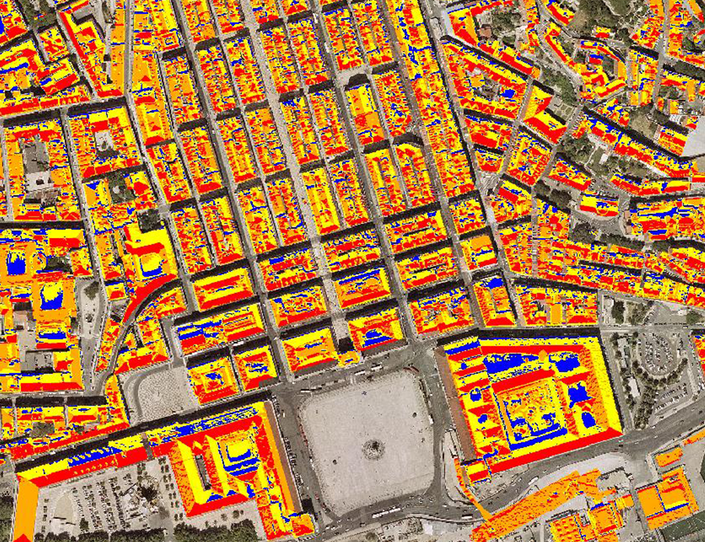
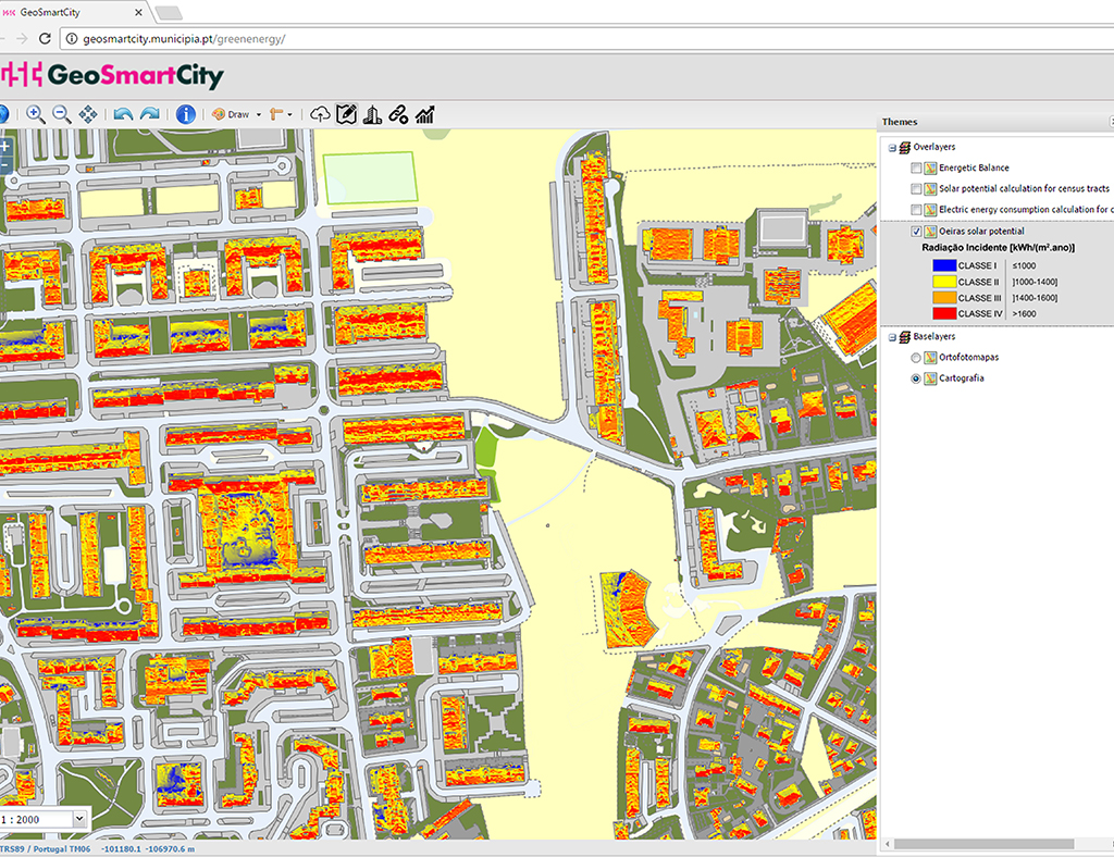
06.
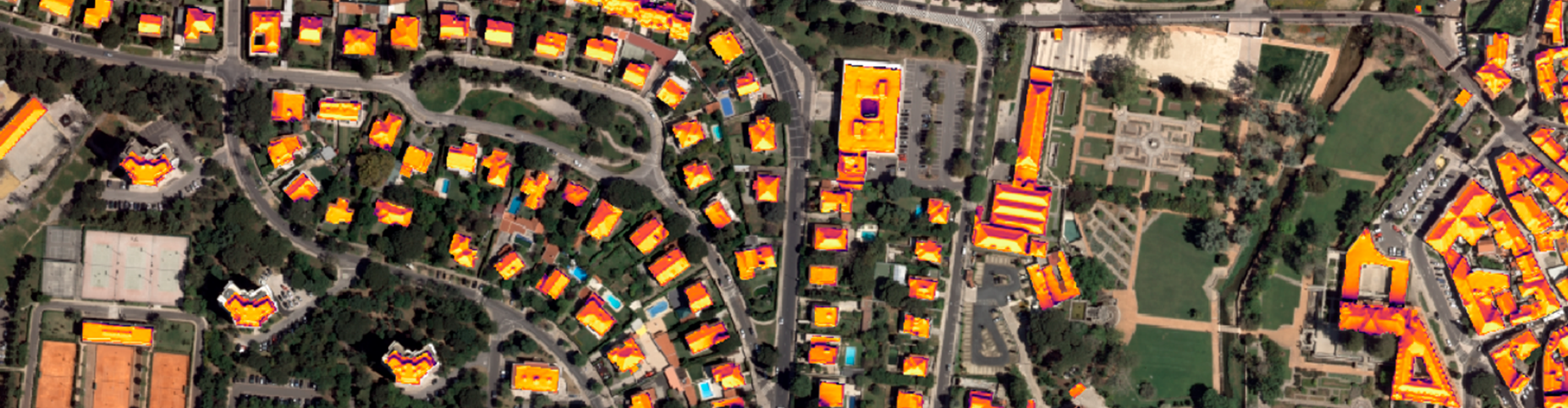
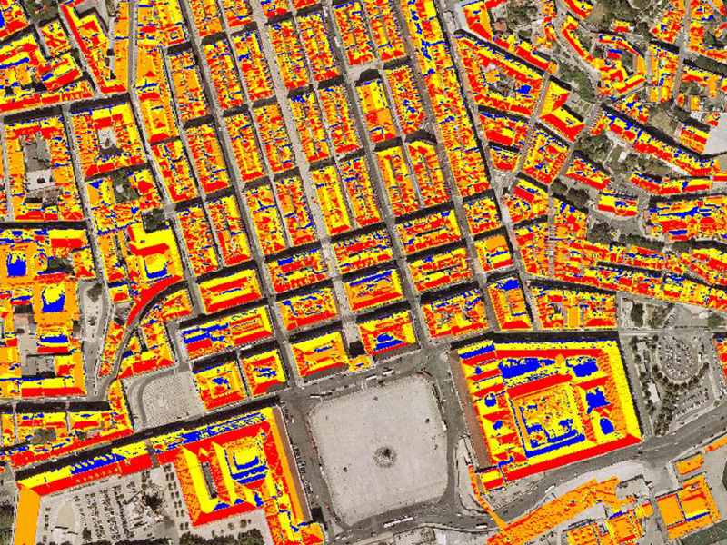
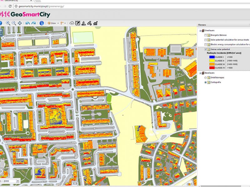
Solar Potential Mapping
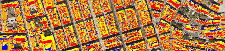
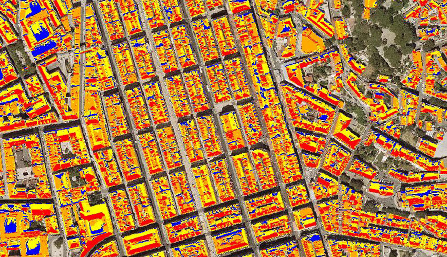
We show you your solar potential.
Our aim with this service is to produce information of public utility that supports consumers when deciding to place solar technologies on their roofs. We classify each building as a source of revenue or energy savings.
Functionalities
- Identification and geographic location of the roofs with the greatest solar potential;
- Justification of Heritage Safeguard Plans at the level of solar roof installations;
- Educate and support the Civil Society in the exploration of this type of Renewable Energy;
- Identification of the most exposed buildings to solar radiation.
Our Advantages
- Speed of execution;
- Accuracy;
- Reuse of previously available information;
- Low cost.