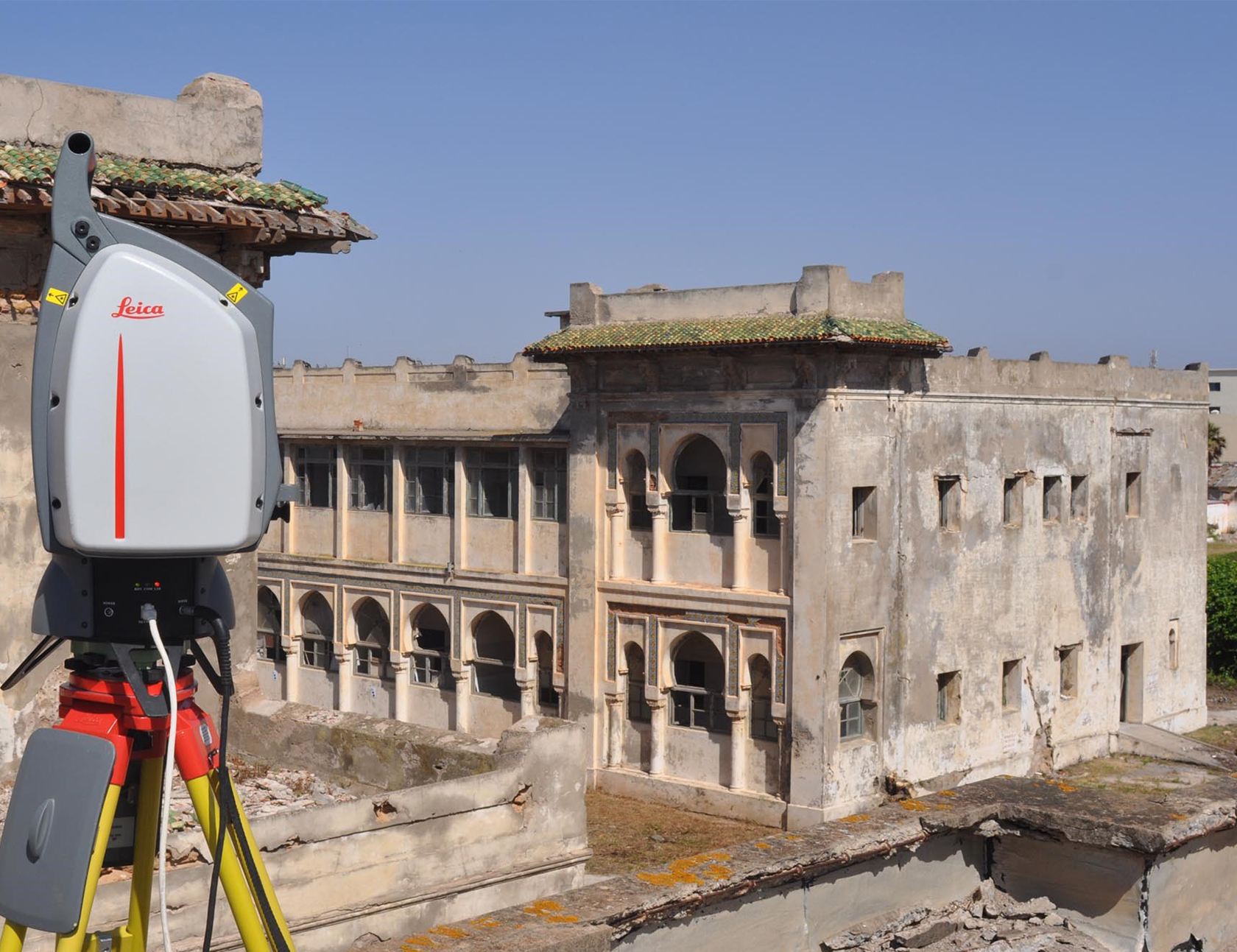
Archive

About the Project: Scope: Identification, mapping and characterization of urban furniture, horizontal and vertical signage and road network Location: Municipality of Oeiras Characteristics: Survey by mobile mapping with image and point cloud; Collection of thematic information in the office; Database supply for direct GIS integration.        ...

About the Project: Scope: Geographic Information Systems Location: Torre de Moncorvo Characteristics: On-job training        ...

About the Project: Scope: Municipal Management Location: Cadaval Municipality Characteristics: Installation of open source software architecture; data transformation between different reference systems (HGD73 for ETRS89 PT TM-06); definition of the system architecture; import of Geographic Information into PostgreSQL / PostGIS according to the INSPIRE directive; implementation of the...

About the Project: Scope: Municipal Management Location: Proença-a-Nova Characteristics: Installation of open source software architecture; data transformation between different reference systems (HGD73 for ETRS89 PT TM-06); definition of the system architecture; import of Geographic Information into PostgreSQL / PostGIS according to the INSPIRE directive; implementation of the data...

About the Project: Scope: Municipal Management Location: Ribeira Grande Characteristics: Installation of open source software architecture; data transformation between different reference systems (HGD73 for ETRS89 PT TM-06); definition of the system architecture; import of Geographic Information into PostgreSQL / PostGIS according to the INSPIRE directive; implementation of the...

About the Project: Scope: Municipal Management Location: Madeira Characteristics: Development and installation of a content management system, with e-government components. Web design. Development and installation of a WebGis platform. Application hosting.          ...

About the Project: Scope: Municipal Management Location: Vale de Cambra Characteristics: Development and installation of a content management system, with electronic government components. Web design. Development and installation of a WebGis platform. Application hosting. Geoportal        ...

About the Project: Scope: Citizenship Location: Cadaval Characteristics: Technological platform supported by OpenSource software; interoperable with respect to data and services, using Open GIS Consortium (OGC) standards; integrated into the existing Spatial Data Infrastructure; Unlimited number of users; Operation in a web environment, being accessible on the internet...