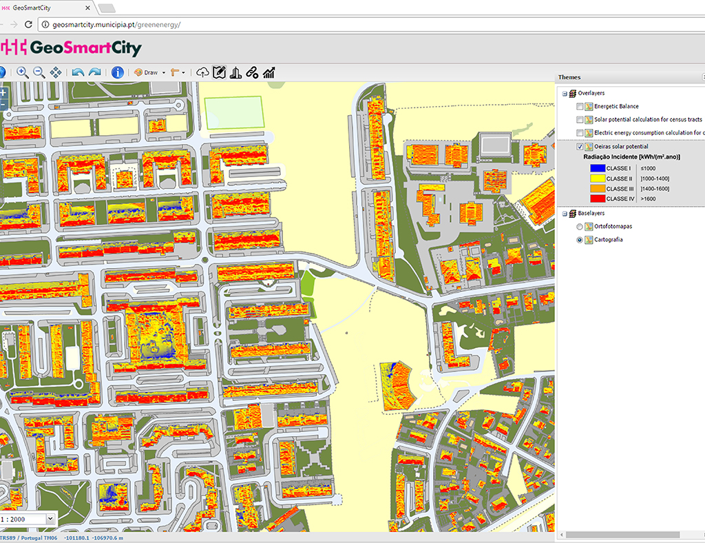
Archive

About the Project: Scope: Renewable energies and underground infrastructure Location: Oeiras Characteristics: Municipia has implemented the “Green Energy” platform, which municipalities are expected to be able to assess their solar potential and compare with their energy consumption, in order to establish more realistic and optimized goals and policies...

About the Project: Scope: Hydrological, Topographical and Cadastral Studies for the Provincial Directorate of Agriculture of Fez - Preliminary Dam Study Location: Morocco - Fez Characteristics: Aerial Photography.                  ...

About the Project: Scope: Management in the Central Government Location: Angola Characteristics: Recruitment and selection of technicians; formation; programming the data collection form using GPS + Netbooks; planning of data collection routes; coordination of fieldwork; data validation; development of the webGIS application for the exploration of census data.        ...

About the Project: Scope: Property Registration Location: Timor-Leste Characteristics: Development of a dedicated GIS platform for Cadastral Management (field and office), design of the Data Model, implementation and quality control of the data and training that allows the following tasks: verification of the quality of the property declarations...

About the Project: Scope: Property Cadastre Place: Mozambique – Nampula (Monapo, Mogincual, Mossuril, Nacala-a-Velha and Memba) Characteristics: RDUAT´s – Regularization of the Right to Use the Land in the province of Nampula in Mozambique with the following activities: Publicity awareness and dissemination publicity; Data collection on the field;...